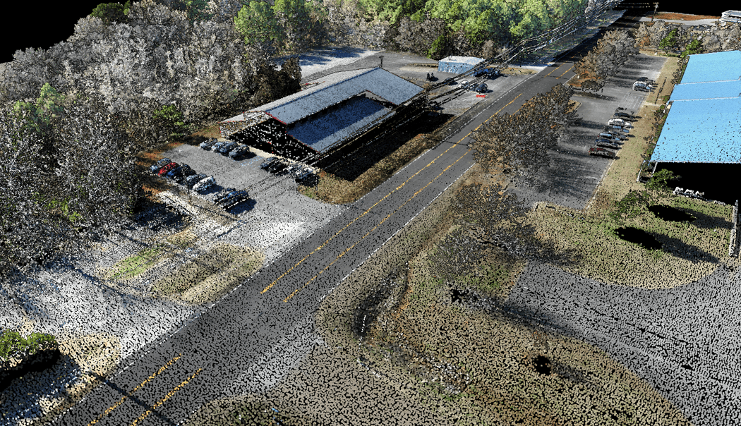
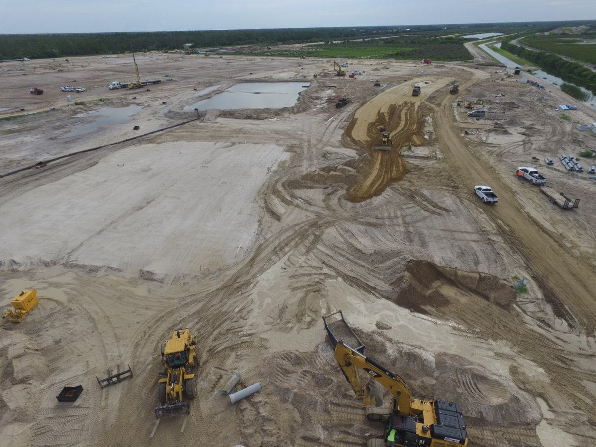
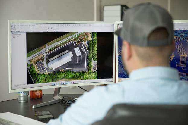
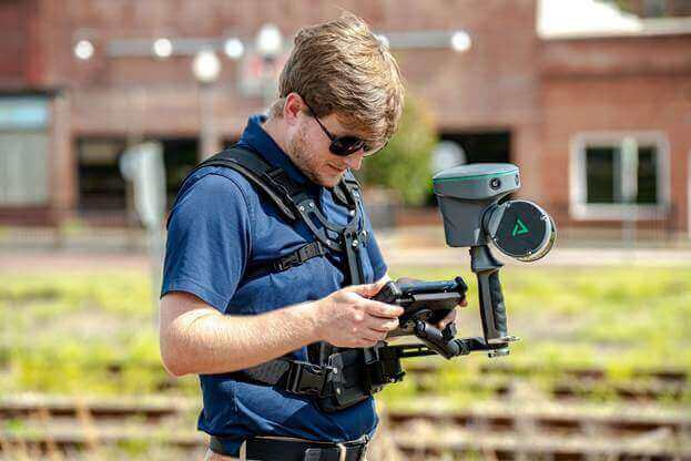
GeoCue’s Jaume Cazorla shows how AI classification in LP360 can help turn large point clouds into usable data for mapping, forestry, and utility projects.
At INTERGEO 2026, GeoCue Customer Success Manager Jaume Cazorla presented “What Can AI Do in LiDAR Processing?” on behalf of his colleague Thadeu Lugarini, GeoCue’s Customer Success Manager for South America, who organized the session. Jaume walked through how AI classifies LiDAR point clouds in LP360, from isolating bare earth for contour maps to identifying individual trees and extracting power lines.
Watch the full presentation below, or keep reading for the highlights and examples from the session.
Watch “What Can AI Do in LiDAR Processing?” on YouTube:
From classifying points to checking results
With better scanners capturing more detail across larger areas, processing can become the bottleneck. In a traditional classification workflow, users select tools, set parameters, run algorithms, and then review and refine the results. With AI classification, a trained model handles the initial pass, giving users more time to check the results and correct areas that need attention.
Jaume explained how the team builds these models using manually classified point clouds. The team trains a model on multiple datasets, tests it on raw data, and uses the errors it finds to improve the next round of training. The data source matters as much as the task. A model trained to identify trees in airborne LiDAR, for example, may see very different point patterns in a scan collected from the ground.
What AI classification looks like in LP360
LP360 now offers four new AI Classification tools designed for different LiDAR workflows. In his INTERGEO presentation, Jaume showed how each tool works with real point cloud data, from mapping bare earth to identifying individual trees and power lines.
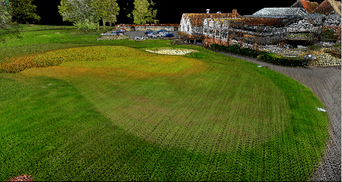
AI Ground identifies bare-earth points beneath vegetation so users can build digital terrain models and generate contours. Jaume showed a wooded site where the ground was difficult to distinguish in the original point cloud.
AI Ground+ expands classification beyond bare earth. In the urban examples, Jaume showed how the workflow separates vegetation and features such as roofs, walls, fences, and vehicles into classes users can review independently.
AI Forestry separates ground and vegetation and identifies individual trees. Jaume also showed how LiDAR can support diameter at breast height (DBH) measurements when the scan captures enough points on the trunk.
AI Utilities identifies power lines, supporting structures, and nearby vegetation. Those classes give teams a starting point for checking how close vegetation is to the lines and identifying potential encroachment.
Where AI classification goes next
The examples in the talk focused mainly on airborne LiDAR. Jaume also discussed extending the models to data from mobile mapping systems, handheld scanners, and terrestrial laser scanners. Each of those capture methods sees a scene from a different perspective, which affects what a model can reliably identify.
Jaume also shared where AI fits into his own workflow. Once he’s satisfied with the point cloud geometry, he sends the data for cloud classification and reviews the results when they come back. Upload and download times factor into turnaround, especially for large datasets. The time savings come from automating the initial classification so he can spend more of his time checking the output and refining the deliverables.
LP360 continues to explore new ways to modernize LiDAR processing with AI classification and other AI-powered tools, so you can spend less time classifying points and more time reviewing the results. Ready to try it on your own data? All four AI Classification tools are available now in the store at LP360.com. Choose the tool that fits your next project and add it to your workflow.
Move project data directly between platforms with cloud-to-cloud imports and exports.
We are excited to announce that Trimble Connect integration is now live in LP360 Cloud! This new capability makes it easier to transfer source data and processed deliverables between your Trimble Connect projects and LP360 Cloud, reducing manual handoffs and helping teams keep project data accessible across both platforms.
With direct cloud-to-cloud transfers, you can move even multi-gigabyte point clouds and orthophotos without downloading them to your local workstation just to upload them again.
Connecting Geospatial Data with Project Collaboration
Trimble Connect is a cloud-based project collaboration platform and common data environment (CDE) for geospatial and architecture, engineering, and construction teams. It provides a central place for project stakeholders to share, view, review, and coordinate models, drawings, and other project information.
The new integration brings that collaboration environment closer to your LP360 Cloud workflow. Import data from an existing Trimble Connect project into LP360 Cloud, then send processed deliverables back to the project folder where your team needs them.
What You Can Do
Import directly from Trimble Connect. Browse your project folders inside LP360 Cloud and copy raw files, sensor data, and point clouds into your LP360 Cloud storage repositories.
Export processed deliverables. Send LAS/LAZ point clouds, orthomosaics, and digital elevation models (DEMs) directly to your selected Trimble Connect project folder.
Transfer large datasets in the background. Move multi-gigabyte files between platforms without routing those transfers through your local workstation or internet connection.
Connect with your existing Trimble ID. Securely authorize access using your Trimble credentials.
Open the Integrations tab in the sidebar, or select Trimble Connect from the Files & Folders action bar.
Click Connect with Trimble ID and sign in with your Trimble credentials.
To import, browse your Trimble Connect folders, select a file, and click Copy to Cloud. To export, select a file in your LP360 Cloud Files view, click Push to Trimble Connect, and choose the destination project folder.
You will need an active LP360 Cloud seat and standard member permissions on your target Trimble Connect project. If the integration is unavailable or you encounter permission issues, contact your organization administrator to confirm your access.
More Help: Step-by-step instructions, screenshots, and troubleshooting tips are available in our internal help guide: LP360 Support Link
Ready to connect your workflow?Sign in to LP360 Cloudand start transferring project data with Trimble Connect today.
Join Our November 18 Webinar to Explore the New Immersive Profile, 3D Photo Engine Improvements, E57 Support, and other new updates to LP360
LP360, the professional choice in LiDAR and photogrammetry 3D point cloud software, has released its final feature update of 2026. LP360 v2026.2 is now available, bringing new visualization tools, improved imagery workflows, expanded sensor support, and more ways to inspect, share, and document your projects.
Join us on Wednesday, November 18, 2026, at 10:00 am CT, for our What’s New in LP360 v2026.2 webinar to see the latest features in action and learn how to put them to work in your next project.
This informative session will highlight practical improvements across point cloud review, photo processing, sensor workflows, quality reporting, and project management. Whether you work with aerial LiDAR, handheld scans, or imagery, the webinar will help you get more from the latest version of LP360.
One of the key highlights is the new Immersive Profile, which combines focused cross-section analysis with an interactive 3D view. Rotate, pan, and zoom through your data to better understand how points relate to surrounding terrain, buildings, vegetation, and utilities. Active Filter controls and improved point-density settings help you focus on the details that matter during editing and quality checks. Users can choose the new Immersive Profile or continue working with the Legacy Profile View.
The 3D Photo Engine also receives several improvements designed to produce cleaner imagery products and more consistent results. Expanded AI photo masking adds Operator and Sky options, while improved multi-camera handling keeps calibration and photo information better coordinated after processing. Enhanced colorization for multi-beam sensors, improved DEM input checks, and additional Cloud processing options further streamline imagery workflows. The 3D Photo Engine requires a separately purchased add-on.
For teams working across different software platforms, new E57 import and export capabilities make exchanging point clouds easier. Bring E57 data into LP360 for processing and analysis, or export project data for downstream reality capture, CAD, BIM, and visualization applications. This added flexibility helps simplify collaboration and reduce separate file conversion steps.
LP360 v2026.2 also expands sensor and platform workflows. RESEPI payload support, available as a beta release, allows users to begin with raw payload data in Import Cycle and continue through a guided Sensor processing workflow. Additional updates include Anzu Raptor platform support, RXP Cutter support in applicable RIEGL workflows, improved handling of DJI Terra folders, and refinements for TrueView processing.
New PDF reports for Strip Alignment and Point Cloud Statistics make it easier to review results and document the work behind your deliverables. Geocoding reports for applicable workflows and TrueNav processing reports for TV1 and TV1 Lite provide additional information for project review and quality control.
The release also includes tools to help keep data cleaner and processing more organized. Optional Flyer and Sinker outlier removal helps eliminate stray points during Geocoding, while the new Delete Points by Class tool provides a direct way to remove unwanted classifications before delivery. Job Manager improvements add Project Filter and Sort By controls, helping users find and manage work across multiple projects.
Together with improved coordinate system selection, licensing, diagnostics, and Help Center guidance, LP360 v2026.2 focuses on helping users spend less time managing processing and more time putting their data to work.
Download the latest version, then join us on November 18 to explore what’s new and learn how these updates can improve your LiDAR and photogrammetry workflows.
Invest in Aerial LiDAR, Handheld Mapping Systems, and Processing Software Before Year-End
If you’re looking to expand your surveying capabilities, add handheld mapping to your services, or upgrade your processing software, Section 179 could help make your next investment more affordable.
For 2025, expanded federal tax provisions give eligible businesses the opportunity to deduct substantial equipment costs in the year qualifying purchases are placed in service. With a higher Section 179 deduction limit and restored 100% bonus depreciation for certain eligible purchases, there’s even more reason to review your equipment plans with your tax advisor.
Whether you’re considering a TrueView aerial LiDAR system, a handheld mapping system from the TrueView GO family, or qualifying LP360 processing software, GeoCue can help you find the tools to move your business forward.
Understanding the Section 179 Deduction
Section 179 allows eligible businesses to elect to deduct the qualifying cost of equipment in the year it is placed in service, instead of depreciating that cost over several years.
For tax years beginning in 2025:
Maximum deduction: $2,500,000.
Phaseout begins: $4,000,000 in total qualifying property placed in service.
Deduction fully phases out: $6,500,000 in total qualifying property placed in service.
Above the $4 million threshold, the maximum deduction decreases dollar for dollar. The deduction is also generally limited by taxable income from the active conduct of a trade or business.
These limits apply across your qualifying purchases for the year, so review your overall equipment investment with your tax advisor.
Aerial LiDAR, Handheld Mapping, and Software
Section 179 can apply to qualifying new or used business equipment and off-the-shelf software. Eligible purchases may include GeoCue LiDAR surveying equipment and qualifying software licenses, depending on your business use and the purchase terms.
For GeoCue customers, that means discussing purchases such as:
TrueView aerial LiDAR systems for drone surveying and mapping.
TrueView GO family handheld mapping systems for expanding your reality capture capabilities.
Qualifying LP360 software licenses for processing LiDAR data and creating deliverables.
Equipment generally must be used more than 50% for business to qualify, and only the business-use portion of its cost is eligible. Financed purchases may also qualify; paying the entire purchase price upfront isn’t necessarily required. Your advisor should review software licensing and bundled services separately to determine their tax treatment.
What’s New: 100% Bonus Depreciation
The One Big Beautiful Bill Act restored 100% bonus depreciation for certain qualifying property acquired and placed in service after January 19, 2025.
This separate provision may provide another way to deduct eligible equipment costs in the first year. Section 179 is generally applied before bonus depreciation, and the same cost cannot be deducted twice. Your tax advisor can help determine how these provisions fit your business and purchasing plans.
The Timing Matters
For calendar-year businesses seeking a 2025 deduction, qualifying equipment must be purchased and placed in service by December 31, 2025.
Placing an order or paying a deposit alone doesn’t meet that requirement. Equipment must be ready and available for its intended business use. Plan ahead for delivery, setup, and any other steps needed to make your system operational.
Put Your Investment to Work
Adding aerial LiDAR, bringing handheld mapping into your workflow, or upgrading your processing software can help your team take on new projects and deliver more value to customers.
Section 179 may help reduce the initial tax impact of that investment. Remember, a deduction reduces taxable income; your actual tax savings depend on your tax rate, eligibility, and financial situation.
Start by reviewing your plans with your tax advisor. Then, work with GeoCue to identify the equipment and software that fit your applications, budget, and delivery schedule.
Important Disclaimer
GeoCue is not a tax advisor. This article provides general information about federal tax provisions and does not constitute tax, legal, or accounting advice.
Before purchasing equipment or software with the intent of claiming a deduction, consult your own tax advisor to confirm eligibility, applicable limits, timing, and federal and state tax treatment.
GeoCue does not guarantee any deduction or tax savings and cannot be held liable if a purchaser is unable to claim an anticipated tax benefit.
Ready to expand your surveying and mapping capabilities? Talk to a GeoCue LiDAR expert about TrueView aerial LiDAR systems, the TrueView GO handheld family, and LP360 software.
Explore Ouster Rev8 technology, practical mapping workflows, and the future of drone LiDAR
Looking to get more from your drone LiDAR workflow? watch the replay of Ouster’s Drone Mapping Summit, a free, 90-minute live webinar in the player below. The event brings together Ouster specialists and industry leaders from GeoCue, Seneca, and Flyability, including our very own COO, Frank Darmayan.
Why is this important for GeoCue customers? The TV1 NDAA UL and TV1 NDAA are the first aerial mapping systems to integrate the Ouster OS1 Max Rev8, expanding the TrueView portfolio with compact options for high-density aerial mapping. The TV1 NDAA UL uses native direct colorization, while the TV1 NDAA adds a 26 MP global shutter mapping camera for projects requiring high-resolution imagery.
Paired with GeoCue’s navigation technology and LP360 processing workflow, these systems help users move from field collection to final deliverables. Understanding the technology behind the sensor is another step toward choosing the right tools for your aircraft, applications, and budget.
What the summit will cover:
Rev8 technology overview — 20 minutes: Explore native color, precision, range, and the compact OS1 Max design.
OS1 Max masterclass — 20 minutes: Review firmware configuration, test datasets in Ouster Studio, and Ouster SDK commands for creating colorized maps.
Industry panel — 50 minutes: Hear GeoCue, Seneca, and Flyability discuss mapping challenges, emerging technology, policy, and career opportunities, followed by live audience Q&A.
The summit is designed for surveyors, mapping providers, drone and payload developers, and teams working with geospatial data. Attendees can also explore sample drone datasets covering utility corridors, forest canopy, and urban environments.
Whether you are evaluating a new LiDAR system or looking for ways to strengthen an existing workflow, join the conversation and bring your questions.
New partnership expands access to GeoCue’s TrueView aerial LiDAR systems and LP360 processing software across the Upper Midwest
GeoCue, a leading provider of high-accuracy LiDAR mapping hardware and geospatial processing software, is pleased to announce Maverick as its newest distribution partner for TrueView aerial LiDAR systems and LP360 geospatial processing software.
Based in Savage, Minnesota, Maverick will primarily serve customers throughout Minnesota and the Upper Midwest while also supporting organizations across the United States through its broader distribution and direct sales network.
Founded in 2014, Maverick is an authorized distributor and integrator of enterprise unmanned systems. That spans aerial platforms, ground and underwater robotics, and the sensors and software that turn what they collect into a usable deliverable. Maverick works across surveying, construction, infrastructure inspection, public safety, energy and utilities, agriculture, and industrial inspection, matching the right system to the job and standing behind it once it’s in the field.
Maverick combines hands-on operational experience with a consultative approach to helping customers select, deploy, and operate new technology. In addition to supplying hardware, the company provides training, technical support, and ongoing operational guidance designed to help organizations successfully integrate new systems into their workflows.
As demand for high-accuracy aerial LiDAR continues to expand, Maverick identified GeoCue’s combination of TrueView hardware and LP360 software as a strong fit for its existing customers and growing geospatial business.
“We’re excited about bringing a complete, professional-grade LiDAR solution to customers in our region who have been asking for better tools and better support,” said Adam Shaw, CEO and Founder of Maverick. “GeoCue’s integrated approach with TrueView and LP360 aligns closely with how we already work with our customers. It is not simply about providing the technology, but helping customers successfully put it to work. We look forward to working closely with GeoCue on demonstrations, training, and ongoing technical support.”
GeoCue’s TrueView aerial LiDAR systems combine LiDAR, imaging, and precision positioning technologies into integrated mapping payloads designed for professional drone surveying and mapping. When paired with LP360, customers gain a connected workflow that takes projects from data collection through processing, classification, QA/QC, analysis, and final deliverables.
For Maverick customers, the partnership will provide additional options for applications including terrain mapping, volumetric analysis, construction documentation, infrastructure mapping, corridor surveying, and other high-accuracy geospatial projects.
The partnership also gives Maverick access to GeoCue’s expanding range of aerial LiDAR configurations, allowing customers to select systems based on their accuracy requirements, applications, aircraft, and budgets.
“Adam and the Maverick team bring the kind of hands-on experience and customer-focused support we look for in our distribution partners,” said Chuck Snow, Eastern U.S. Sales Manager at GeoCue. “Their customers will also benefit from the range of options available across the TrueView aerial LiDAR portfolio, particularly organizations looking for NDAA-compliant equipment. From the TV1 NDAA through the TrueView 720, GeoCue now offers one of the most complete NDAA-compliant LiDAR portfolios on the market. That gives Maverick the ability to meet customers where they need to be based on their application, performance requirements, and budget.”
The addition of Maverick strengthens GeoCue’s distribution and support network in the Upper Midwest while providing surveying, engineering, construction, utility, and inspection professionals with greater access to complete aerial LiDAR solutions.
“Customers are increasingly looking for solutions that simplify the path from collecting data in the field to producing the deliverables they need,” Shaw added. “TrueView and LP360 provide that connected workflow without requiring users to piece together multiple disconnected platforms.”
Maverick will support customers with product demonstrations, system selection, training, and ongoing technical guidance for both TrueView hardware and LP360 software.
About Maverick
Founded in 2014 and headquartered in Savage, Minnesota, Maverick Drone Systems, L.L.C. is an authorized distributor and integrator of enterprise unmanned systems, sensors, and supporting technologies. The company serves customers in surveying, construction, infrastructure, public safety, energy and utilities, agriculture, and industrial inspection, providing hardware, training, support, and operational guidance to help organizations successfully deploy drone technology in real-world applications.
A practical look at surveying services for construction contractors, with a particular focus on major railway corridor projects
This article was featured in the August 2026 issue of the German Surveying VDV Magazine, written by Kossert, the Surveying Project Manager at Spitzke, a customer of GeoCue.
By Guido Kossert
On major corridor projects, it’s not only the volume of construction work that grows with the size and complexity of the project. The supporting services around that work grow as well. Surveying is a perfect example. It plays an important role before construction begins, throughout the work itself, and again at the completion of the project. Simultaneously, surveying teams are being asked to do more with tighter schedules and with fewer available specialists. New and more efficient technologies are helping close that gap. This article looks at several typical surveying applications in railway infrastructure construction.
How LiDAR and Other Technologies Are Changing Construction Surveying
On most construction projects, the contractor is responsible for carrying out or commissioning surveying services in addition to the construction work itself. That includes collecting supplemental data before work begins, supporting construction planning, providing data for machine control, establishing the design track position, and setting out a wide range of construction activities, particularly in civil engineering. Surveying is also required to confirm that the completed work matches the original design plans.
Depending on the size and complexity of the project, the need for up-to-date surveying data can be significant. Because much of this work takes place before construction begins, during breaks in activity, or after other phases are complete, it often goes unnoticed when a project is evaluated. Even so, it plays a critical role in construction accuracy and can have a significant impact on both scheduling and budget.
Staffing is an important part of that challenge. In the past, a larger surveying workload could often be handled simply by assigning more people. Today, qualified personnel are harder to find, so technology has become increasingly important. Systems such as LiDAR allow teams to collect far more data with fewer people and in less time.
These technologies also create opportunities that extend beyond the traditional measurement of site conditions. They can support areas such as material logistics, project documentation, and construction planning. At the same time, larger datasets shift more of the workload from the field to the office. Processing can require substantial computing power, storage capacity, and reliable methods for transferring data. On large projects, datasets can quickly reach the terabyte range. Sensor technology is becoming more accessible, but it still represents a meaningful investment and must be planned accordingly.
Figure 1: Hamburg to Berlin corridor rehabilitation. Numerous structures, especially in station areas, create a high demand for surveying data.
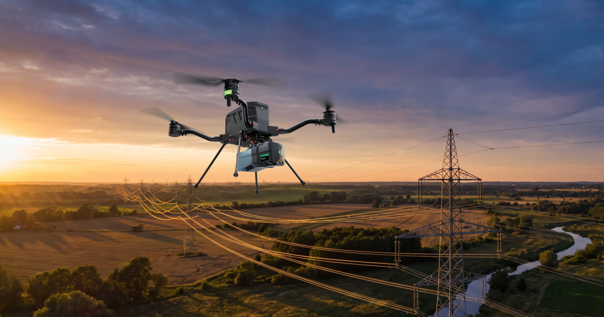
Figure 2: DJI M300 RTK drone equipped with a TrueView LiDAR system for aerial data capture.
Source for all figures: Spitzke SE.
Before Construction Begins
Contractors typically receive surveying data from the client, often as part of the overall design plan. The information may come from the client’s own records or from outside service providers. For major projects, DB InfraGO (the public-interest infrastructure subsidiary of Deutsche Bahn responsible for managing and operating Germany’s rail network and passenger stations) also frequently provides aerial survey data through its X2BIM platform. Even with these resources, a rail network of roughly 39,000 kilometers presents obvious challenges.
Existing records can vary widely, especially when they were created at different times or with different coordinate systems. Newer railway infrastructure data are generally based on the DB_REF 2016 standard, which replaced DB_REF 2003. In some areas, older Gauss Kruger data can still be found, and parts of former East Germany may contain records based on Krassowski ellipsoid projections. Because these systems do not align directly, corrections and careful checks may be required.
Older secondary lines can present another challenge. As-built information may be incomplete or missing altogether. Even when data exists, site conditions may have changed because of natural ground movement, reconstruction, or events such as the 2021 flooding. Corridor projects add another layer of complexity because the area being surveyed can be so large that months, and sometimes years, may separate the newest and oldest datasets by the time all information has been reviewed, collected, and processed.
That becomes especially important in locations where tight tolerances must be maintained, such as machine-controlled construction or station areas with specific clearance requirements. As a result, supplemental surveying before construction can vary greatly from one project to another.
Even when the starting data is good, additional measurements may be needed to answer specific planning questions. Potential conflicts may be identified during design, or the available cross sections may not be detailed enough to accurately represent the track geometry. On the Nuremberg-to-Regensburg corridor, for example, a planned realignment from the no-longer-permitted 3.5-meter track spacing to the 4.5-meter spacing required for new construction meant that fixed constraints, including bridges and mast locations, had to be evaluated very carefully.
The way surveying is organized depends on the task, the local environment, and how accessible the line is while it remains in service. Safety always comes first. On the Hamburg to Berlin corridor, where Spitzke worked with Leonhard Weiss on Lot 2, surveying in Spitzke’s assigned sections began more than six months before the main construction phase. One reason was the time required to process the newly collected data and compare it with the design and existing condition data. The Right Rhine corridor rehabilitation, which entered construction in July 2026, also required extensive advance surveying, although the amount varied by location.
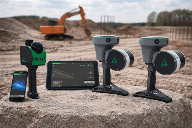
Figure 3: Wearable LiDAR system, TrueView GO, with interface and ergonomic carrying support.
Figure 4: On the Nuremberg to Regensburg corridor, some overhead line mast locations were so difficult to access that foundation pipes, masts, and box foundations had to be flown into position.
Data Capture During Railway Operations
For an as-built survey or an update to existing datasets, a survey using a mobile mapping system, or MMS, can be an efficient option. On the DB InfraGO network, Trimble’s MX9 is approved for track surveying in accordance with Ril 883 [2]. Mobile mapping systems are typically built as multisensor platforms that combine LiDAR, cameras, GNSS, and an inertial measurement unit, or IMU. By combining these technologies, the position of LiDAR measurements can be determined accurately even in tunnels or other obstructed environments.
The IMU does require a minimum speed to produce reliable trajectory data. In general, the vehicle should travel above 40 kilometers per hour, although newer systems can provide good results at around 20 kilometers per hour. Stops should still be avoided because the measurement process may need to be reinitialized. That makes long distance MMS surveying more difficult during active construction, when tracks are occupied by construction operations and frequent stops are likely.
A mobile GEDO IMS system provides another option. Because it combines a track measurement trolley with IMU sensors, it is not dependent on continuous travel at a constant speed. Across the three corridor projects discussed here, both the MX9 and GEDO IMS systems were successfully used by Gi Consult as a subcontractor, or surveys were completed before the lines were returned to service.
MMS can capture a detailed picture of the track position and the environment around it in a relatively short amount of time. Minimum speed requirements can reduce resolution in some areas, so additional detailed measurements may still be necessary. Even so, surveying roughly 100 kilometers of track with MMS can often be completed in less than a day. As with many modern surveying methods, much of the total effort comes later during processing.
Where overflight approval is available, a drone equipped with LiDAR can also collect data while the railway remains in operation. This approach is especially useful in difficult to access areas because high point cloud densities can be achieved without requiring the operator to enter the track or danger zone.
Figure 5: Visualization of restricted clearance measurements in station and signal areas.
Surveying Slopes
Slopes often combine several difficult conditions. Track sections may not be safely accessible from the outside, and the slopes themselves can be affected by geological movement or erosion. That means the survey may need to capture not only the track position, but also the full slope surface.
This may be necessary to plan a realignment or, as on the Right Rhine corridor, to support extensive slope stabilization work. In those situations, current survey data is needed for both design and setting out. An MMS survey run or drone flight can provide the base dataset. If more detail is required, the information can then be supplemented on a closed track using a rail mounted system or a handheld LiDAR scanner such as the system shown in Figure 3.
Explosive Ordnance Surveying
At first glance, checking a construction area for unexploded ordnance may seem unrelated to surveying. In practice, surveying can be essential, especially for railway electrification or overhead line renewal projects that require deep excavation.
On large corridor projects, it would be impractical to survey the entire track area for ordnance. A more efficient approach is to focus on the locations where earthwork will take place, such as future overhead line mast positions. Those locations must therefore be identified and set out in advance.
On the Nuremberg to Regensburg corridor, this work began almost a year before construction. Millimeter level accuracy was not necessary for the initial guidance of ordnance detection teams because the detection process itself includes a substantial safety buffer. That allowed the surveying method to be selected based on the local conditions and the most efficient workflow.
For most of the work, RTK rovers were used. With GNSS, they achieved an accuracy of about plus or minus 2 to 3 centimeters. Using two rovers, the team set out 1,180 overhead line mast locations in approximately two weeks. A conventional total station approach would have taken at least twice as long.
During and After Construction
Surveying remains critical throughout active construction. A large share of the work involves setting out planned construction activities, especially civil engineering work in areas where precise survey data is critical.
Another major task is documenting completed work for the client. This includes design versus as-built comparisons and, where necessary, documentation that supports change orders. The methods used can cover nearly the full range of approved surveying technologies, depending on the site conditions and the level of accuracy required.
Documenting restricted clearance locations is one of the most important tasks during or after construction. Modern surveying technologies can also support construction directly, including logistics and material planning.
Restricted Clearance Surveys
On existing lines, most relevant restricted clearance locations are already known and are included in the information provided by the client. These locations are commonly found around bridges, signals, tunnels, and especially in station areas.
After construction, the affected locations must be measured again to confirm that safe railway operations remain possible. Any new restrictions created by the work must also be added to the final as-built records.
On open track, point specific measurements are often sufficient because potential conflicts can usually be ruled out visually or are limited to short sections. Station areas are different. Infrastructure is much more concentrated, so construction work and final conditions need to be monitored and documented with much greater care.
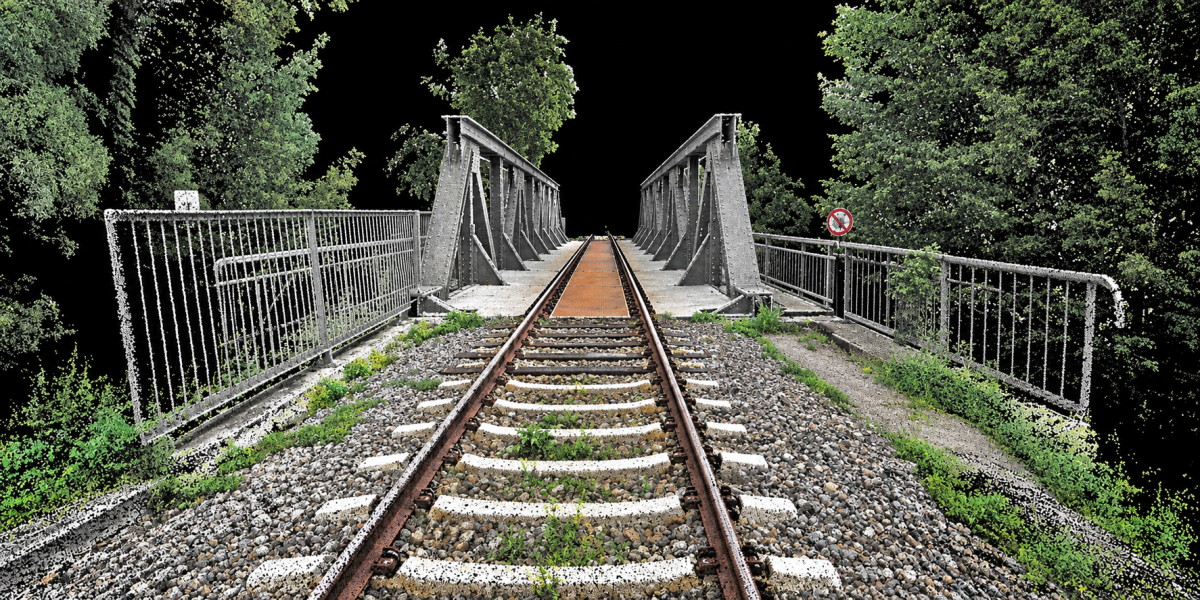
Figure 6: Point cloud representation of a railway overpass on the Neustadt Glewe to Parchim project, captured with a handheld LiDAR scanner.
Measuring Material Volumes
Large construction projects move large amounts of material, and transportation capacity needs to be planned as accurately as possible. This applies to sleepers, rails, ballast, and often significant quantities of earth.
On the Neustadt Glewe to Parchim project, which was carried out in parallel with the Hamburg to Berlin corridor work, extensive construction was planned along the trackside paths and the railway embankment. Site conditions and vegetation had changed enough that the available design data and photographic records no longer provided a reliable basis for estimating earthwork volumes.
LiDAR provided a practical solution. During an existing corridor closure, approximately 16 kilometers of the affected section were walked and scanned from both sides in a single day using the TrueView GO handheld LiDAR scanners. The resulting data made it possible to classify vegetation and other elements that could distort the calculation, then determine the volume of earth that needed to be removed or placed.
With that information, transportation could be planned more accurately and resources could be used more efficiently. The same approach can be used for material stockpiles on staging areas. The TrueView GO 116S scanner can often measure a stockpile faster and more accurately than counting truckloads or relying on simplified geometric assumptions.
The workflow is straightforward. The operator walks around the stockpile with the scanner, and the captured data are then processed in software to calculate volume.
Figure 7: LiDAR capture of a stockpile on a storage area on the Hamburg to Berlin project.
Conclusion
The examples in this article are not intended to cover every possible use of construction surveying. They do, however, show how well-planned surveying services can support major projects when teams have the right technology and enough time to use it effectively.
New technologies continue to expand what’s possible. They allow teams to collect more data, target that data more precisely, and complete the work in less time. They can also reduce disruption to railway operations by limiting the need for track closures and improve safety by keeping personnel out of difficult or hazardous areas.
The key is to recognize surveying as an essential part of project delivery, not simply as a supporting task. The industry also needs to continue attracting young professionals to railway infrastructure surveying. That includes recognizing the value of new technologies and creating approval and certification processes that allow those tools to be used effectively.
Sources
[1] Bauer, F.; Sauer, C.: Reconstruction of the Eifel line after flood damage, EI 03/2023, pp. 44 to 48.
[2] Ramann, J.; Sinning, A.; Wegner, V.: Introduction of Mobile Mapping for Track Surveying, EI 04/2023, pp. 19 to 24.
Author Guido Kossert Surveying Engineer Spitzke SE, Grossbeeren
See the TrueView GO NEO, 116S, and 132S in action and discover fast 3D reality capture workflows for construction, BIM, digital twins, and site documentation.
Taking place October 12–15, 2026, at the Boise Centre, R-CON brings together professionals working across construction technology, reality capture, LiDAR, laser scanning, BIM/VDC, digital twins, photogrammetry, drones, AI, and more. It’s a conference built around real-world workflows, hands-on technology, and conversations between the people who are actively changing how projects are captured, managed, and delivered.
That makes R-CON a great fit for GeoCue. Look for us in Booth 14!
Whether you’re documenting a construction site, capturing existing conditions, creating a digital twin, supporting Scan-to-BIM workflows, mapping industrial assets, or collecting infrastructure data, TrueView GO provides a fast and flexible way to capture high-quality 3D mapping data indoors and outdoors.
And we don’t just want to tell you about it.
Come try it for yourself.
We’ll have our handheld systems on site so R-CON attendees can experience just how easy mobile reality capture can be. Walk a space, collect your data, and see how a connected GeoCue workflow takes you from field capture into processing, visualization, analysis, and final deliverables.
Three Handheld LiDAR Systems. One Connected Workflow.
The TrueView GO family gives reality capture professionals options for different environments, applications, and performance requirements.
The TrueView GO NEO provides an extremely portable solution for indoor mapping, building documentation, construction interiors, facility mapping, and digital twin applications.
The TrueView GO 116S expands those capabilities for professional outdoor and mixed-environment projects, including infrastructure, utilities, corridors, asset mapping, and site documentation.
For projects requiring additional detail and performance headroom, the TrueView GO 132S delivers higher-density capture for demanding infrastructure and complex mapping environments.
Across the portfolio, TrueView GO combines LiDAR, imaging, positioning technologies, and mobile SLAM with GeoCue’s LP360 Land processing software. That means users can move from data collection to point cloud processing, registration, colorization, quality review, editing, analysis, and deliverable creation within one connected ecosystem.
See How Easy It Is to Create a Gaussian Splat
One workflow we’re especially excited to demonstrate at R-CON is Gaussian Splatting with the TrueView GO NEO.
Capture a space with the NEO and see how that field data can be transformed into an immersive 3D visualization that provides an incredibly realistic way to explore and communicate an environment.
For construction teams, engineers, BIM/VDC professionals, facility managers, and reality capture specialists, technologies like Gaussian Splatting open up new ways to document spaces, visualize project conditions, communicate with stakeholders, and create engaging digital representations of real-world environments.
We’ll show you the workflow firsthand.
Meet GeoCue at R-CON 2026
R-CON describes itself as the place “where pioneers meet to redefine the future,” bringing together contractors, owners, engineers, surveyors, technology providers, and other professionals pushing reality capture and construction technology forward.
We’re looking forward to being part of that community for the first time.
If you’ll be in Boise, stop by and meet the GeoCue team, get hands-on with the TrueView GO NEO, 116S, and 132S, and see how simple it can be to move from handheld LiDAR capture to finished 3D deliverables with LP360.
R-CON 2026 October 12–15, 2026 Boise Centre 850 W Front St Boise, Idaho
Come scan with us and experience the TrueView GO workflow for yourself!
The TrueView 550 Advances the 500 Series with Dual Mapping Cameras, Providing a Larger FOV, and latest technology high performance LiDAR
From INTERGEO 2026, GeoCue is announcing the latest addition to its standard aerial LiDAR portfolio with the launch of the TrueView 550, a new high performance mapping system designed to advance the capabilities established by the proven TrueView 539 and TrueView 540.
Combining next-generation LiDAR, dual 20 MP cameras with an expanded field of view, and a choice of GeoCue’s TrueNav GNSS-Inertial navigation system or the Applanix APX-20, it delivers detailed, accurately positioned, colorized point clouds and represents the highest-performing TrueView sensor in GeoCue’s Standard range.
Pictured Above: The TrueView 550 Aerial LiDAR Mapping Sensor
Designed to deliver performance approaching higher-end aerial LiDAR systems at a more accessible price point, the TrueView 550 provides surveying, engineering and geospatial professionals with a new balance of range, accuracy, imaging capability, performance and value.
A True GeoCue Integration
At the core of the TrueView 550 is the latest advanced LiDAR scanner technology, engineered for aerial surveying applications ranging from traditional topographic mapping to challenging, high-relief terrain.
The LiDAR technology supports ranging capabilities of up to 2,100 meters and typical flight altitudes ranging from 100 to 600 meters AGL, giving operators greater flexibility when planning projects over varying terrain and larger project areas. Advanced waveform processing helps improve point-cloud density and data completeness, while the scanner is capable of collecting up to 1 million points per second at 120 meters AGL, providing the detailed 3D information required for professional mapping applications.
“The TrueView 550 is a true GeoCue product made in USA,” said Frank Darmayan, CEO of GeoCue. “We are combining the latest advanced LiDAR technology, GNSS-INS, and dual mapping cameras for a wider Field of View. The result is a completely unique TrueView sensor that gives customers the level of accuracy and performance they expect from an engineering-grade system, but at a much more accessible price point.”
Dual Cameras for Improved Mapping and Colorization
The TrueView 550 incorporates two 20 MP global shutter mapping cameras, providing an ultra-wide imaging field of view and expanding the amount of visual information captured during each flight.
The dual-camera configuration is designed to improve point-cloud colorization while providing high-resolution imagery that gives users additional visual context for feature identification, inspection and deliverable creation.
Pictured Above: The TrueView 550 integrates two 20 MP Global Shutter Mapping Cameras
By capturing precision LiDAR measurements and detailed RGB imagery simultaneously, the TrueView 550 is well suited for applications including professional surveying, engineering, infrastructure mapping, corridor projects, topographic mapping, construction documentation and other high-accuracy reality-capture projects.
Like other TrueView systems, the TrueView 550 is integrated with GeoCue’s complete workflow, from field data collection through processing and deliverable creation in LP360.
Choose the Positioning System That Fits Your Mission
Customers can configure the TrueView 550 with either GeoCue’s TrueNav GNSS-Inertial navigation system or upgrade to the Applanix APX-20 GNSS-Inertial navigation system for enhanced positioning performance.
The APX-20 option also provides access to unlimited Trimble PP-RTX post-processing, eliminating the need for a base station in the field. Using corrections from a global satellite and reference network, PP-RTX delivers centimeter-level positioning accuracy without additional ground equipment, creating a streamlined workflow for professional surveying and mapping projects.
“The LiDAR market continues to evolve, and our customers have different requirements depending on the projects they are taking on,” said Vivien Heriard-Dubreuil, CEO of mdGroup, GeoCue’s parent company. “With the TrueView 550, we wanted to give customers more choice. They can select our TrueNav positioning system for a powerful, integrated GeoCue solution, or choose the Applanix APX-20 for enhanced GNSS-inertial performance and access to unlimited PP-RTX processing. That flexibility, combined with the performance of the new LiDAR and dual imaging system, makes the TrueView 550 the highest-performing sensor in our standard portfolio.”
Expanding Both Standard and NDAA-Compliant LiDAR Options
The TrueView 550 announcement comes fresh off GeoCue’s successful exhibition at Commercial UAV Expo 2026 in Las Vegas, where the company introduced the TV1 NDAA UL and TV1 NDAA, two new systems developed in partnership with Ouster that significantly expanded GeoCue’s NDAA-compliant aerial LiDAR portfolio.
Both systems integrate the Ouster OS1 MAX REV8, featuring a 256-channel architecture capable of collecting up to 10.4 million points per second with practical detection range of up to 200 meters at 10% reflectivity.
The TV1 NDAA UL provides a lightweight, high-density mapping option that takes advantage of the OS1 MAX REV8’s native direct colorization, eliminating the need for a separate external mapping camera to colorize the point cloud. Its smaller, lighter design makes it especially well-suited for compact multirotor and fixed-wing UAV platforms.
The TV1 NDAA builds on the same high-density Ouster LiDAR technology while adding an integrated 26 MP global shutter mapping camera, providing detailed point clouds and high-resolution imagery within the same flight.
With those new NDAA-compliant options now joining GeoCue’s portfolio, the TrueView 550 represents the next step in strengthening and diversifying the company’s standard professional LiDAR range, ensuring customers can select technology based on their individual performance, compliance, aircraft and budget requirements.
Building the Portfolio Around Customer Needs
The addition of the TrueView 550 further broadens a TrueView portfolio that now ranges from accessible professional mapping systems through advanced engineering-grade and NDAA-compliant aerial LiDAR solutions.
Rather than building a portfolio around the number of products available, GeoCue continues to evaluate where gaps exist in the market and where new technology can provide customers with a more appropriate tool for their application.
“We look for gaps and opportunities where we can better fulfill the needs of our customers and respond to what the market is asking for,” said Vincent Legrand, Vice President of Global Sales at GeoCue. “The TrueView 550 fills an important position in our standard range, just as the new TV1 NDAA systems expanded our compliant range. Having strong options across both our Standard and NDAA-compliant portfolios gives GeoCue the ability to help customers select the right tool for the work they actually need to accomplish.”
New TV1 NDAA UL and TV1 NDAA bring Ouster Rev8 performance, lightweight design and more accessible options to GeoCue’s growing NDAA lineup
The demand for NDAA-compliant drone technology continues to grow, and GeoCue is responding with even more choices for aerial mapping professionals.
At Commercial UAV Expo 2026 in Las Vegas, GeoCue announced the addition of two new systems to its growing NDAA-compliant TrueView aerial LiDAR portfolio: the TV1 NDAA UL and TV1 NDAA.
Starting at $40,000, these new sensors provide smaller, lighter and more accessible options for organizations looking to add NDAA-compliant LiDAR capabilities without sacrificing the data quality and workflow that TrueView users expect.
And most importantly, they give GeoCue customers even more ways to select the right NDAA-compliant sensor for their aircraft, applications and budget.
Expanding the TrueView NDAA Portfolio
GeoCue has seen significant growth in demand for NDAA-compliant aerial LiDAR, particularly from government, state, local and education, or SLED organizations, along with commercial firms supporting those markets.
The TrueView 641 NDAA and TrueView 651 NDAA have already established strong positions within GeoCue’s portfolio for customers requiring high-quality engineering and survey-grade mapping capabilities. The addition of the TV1 NDAA UL and TV1 NDAA extends that lineup with two new options designed around lighter weight, accessibility and high-density data collection.
“This year, our best-selling drone LiDAR system has been the TrueView 641 NDAA-compliant sensor, providing high quality, engineering grade data and we have heard the need for more NDAA-compliant options loud and clear,” said Frank Darmayan, CEO of GeoCue. “The TV1 NDAA UL and TV1 NDAA help fill that gap and further extend our NDAA-compliant sensor lineup.”
GeoCue is also in the process of submitting the TV1 NDAA UL for Green UAS approval to support additional compliance requirements across government and commercial markets.
The 256-channel LiDAR architecture is capable of collecting up to 10.4 million points per second, putting more points on the ground while allowing operators to fly faster and collect larger areas efficiently.
With a practical detection range of up to 200 meters at 10% reflectivity, the Rev8 also gives operators the ability to fly longer, higher and faster while maintaining the density and detail needed for professional mapping applications.
Combined with GeoCue’s TrueView integration, navigation technology and LP360 processing workflow, the result is a new generation of compact aerial LiDAR systems designed to make high-density data collection easier and more productive.
TV1 NDAA UL: Lightweight LiDAR with Native Colorization
For operators focused on keeping payload weight to a minimum, the TV1 NDAA UL offers a great new, accessible option.
Built around the Ouster OS1 MAX REV8, the TV1 NDAA UL uses native 48-bit direct colorization to assign precisely aligned RGB values to each 3D point as data is captured.
That means there is no need for a separate external mapping camera simply to colorize the point cloud.
The result is a compact and lightweight sensor particularly well suited for smaller multirotor aircraft and fixed-wing UAVs, where every gram of payload can affect endurance, flight time and overall mission efficiency.
For organizations that need NDAA compliance but do not necessarily need a separate high-resolution mapping camera, the TV1 NDAA UL creates an entirely new option within the TrueView lineup.
TV1 NDAA: LiDAR and High-Resolution Imagery Together
For projects where high-resolution imagery is part of the deliverable, the TV1 NDAA adds an integrated 26 MP global shutter mapping camera to the same Ouster Rev8 LiDAR platform.
Designed and manufactured at GeoCue’s Alabama facility, the system captures detailed point clouds and high-resolution imagery during the same flight.
That combination makes it a strong fit for applications including topographic mapping, construction documentation, infrastructure inspection, corridor mapping and other professional reality-capture projects.
“It was in 2025 that we introduced the TV1 Lite and TV1, expanding our professional portfolio of LiDAR sensors and giving an entry solution to our customers,” said Vivien Heriard-Dubreuil, CEO of mdGroup, GeoCue’s parent company. “It makes perfect sense to return in 2026 to further expand our NDAA-compliant portfolio in a similar way.”
“The additions of the TV1 NDAA and TV1 NDAA UL, both designed and made in America, demonstrate how GeoCue continues to adapt to the market and provide customers with the tools they need to get the job done.”
More NDAA Choices & One Complete LiDAR Workflow
The biggest story behind these two new systems isn’t simply the addition of two more sensors. It’s the continued expansion of the entire GeoCue NDAA-compliant portfolio.
Customers now have more choices across different aircraft sizes, budgets, accuracy requirements and project types while staying within the same TrueView and LP360 ecosystem.
“I can say with great confidence that the addition of the TV1 NDAA UL and TV1 NDAA gives the TrueView aerial LiDAR portfolio a range unlike anything else in the aerial mapping market,” said Vincent Legrand, Vice President of Global Sales at GeoCue.
“We now offer multiple options across both our NDAA-compliant and professional LiDAR portfolios. Combined with LP360 processing software and our experienced training and support teams, GeoCue provides an unmatched resource for aerial LiDAR data collection, processing and deliverable creation.”
Find the Right NDAA-Compliant TrueView for Your Mission
With the addition of the TV1 NDAA UL and TV1 NDAA, GeoCue continues to broaden its NDAA-compliant offering and make advanced aerial LiDAR available for an even wider range of users and UAV platforms.
Whether the priority is a lightweight payload, integrated high-resolution imagery, engineering-grade mapping or more advanced survey applications, there is now an even wider range of TrueView NDAA options available.
The goal is simple: give mapping professionals the ability to select the right tool for the job while maintaining the hardware, software, training and support ecosystem that makes TrueView a complete LiDAR mapping solution.
Explore the TV1 NDAA UL and TV1 NDAA and discover where they fit within your aerial LiDAR workflow.