Categories
LiDAR Articles LiDAR For Construction LiDAR For Education LiDAR For Engineering LiDAR For Utilities & Energy LiDAR News Software News

How to Take Advantage of Section 179 for LiDAR Equipment in 2025

Invest in Aerial LiDAR, Handheld Mapping Systems, and Processing Software Before Year-End

If you’re looking to expand your surveying capabilities, add handheld mapping to your services, or upgrade your processing software, Section 179 could help make your next investment more affordable.

For 2025, expanded federal tax provisions give eligible businesses the opportunity to deduct substantial equipment costs in the year qualifying purchases are placed in service. With a higher Section 179 deduction limit and restored 100% bonus depreciation for certain eligible purchases, there’s even more reason to review your equipment plans with your tax advisor.

Whether you’re considering a TrueView aerial LiDAR system, a handheld mapping system from the TrueView GO family, or qualifying LP360 processing software, GeoCue can help you find the tools to move your business forward.

Understanding the Section 179 Deduction

Section 179 allows eligible businesses to elect to deduct the qualifying cost of equipment in the year it is placed in service, instead of depreciating that cost over several years.

For tax years beginning in 2025:

  • Maximum deduction: $2,500,000.
  • Phaseout begins: $4,000,000 in total qualifying property placed in service.
  • Deduction fully phases out: $6,500,000 in total qualifying property placed in service.

Above the $4 million threshold, the maximum deduction decreases dollar for dollar. The deduction is also generally limited by taxable income from the active conduct of a trade or business.

These limits apply across your qualifying purchases for the year, so review your overall equipment investment with your tax advisor.

Aerial LiDAR, Handheld Mapping, and Software

Section 179 can apply to qualifying new or used business equipment and off-the-shelf software. Eligible purchases may include GeoCue LiDAR surveying equipment and qualifying software licenses, depending on your business use and the purchase terms.

For GeoCue customers, that means discussing purchases such as:

  • TrueView aerial LiDAR systems for drone surveying and mapping.
  • TrueView GO family handheld mapping systems for expanding your reality capture capabilities.
  • Qualifying LP360 software licenses for processing LiDAR data and creating deliverables.

Equipment generally must be used more than 50% for business to qualify, and only the business-use portion of its cost is eligible. Financed purchases may also qualify; paying the entire purchase price upfront isn’t necessarily required. Your advisor should review software licensing and bundled services separately to determine their tax treatment.

What’s New: 100% Bonus Depreciation

The One Big Beautiful Bill Act restored 100% bonus depreciation for certain qualifying property acquired and placed in service after January 19, 2025.

This separate provision may provide another way to deduct eligible equipment costs in the first year. Section 179 is generally applied before bonus depreciation, and the same cost cannot be deducted twice. Your tax advisor can help determine how these provisions fit your business and purchasing plans.

The Timing Matters

For calendar-year businesses seeking a 2025 deduction, qualifying equipment must be purchased and placed in service by December 31, 2025.

Placing an order or paying a deposit alone doesn’t meet that requirement. Equipment must be ready and available for its intended business use. Plan ahead for delivery, setup, and any other steps needed to make your system operational.

Put Your Investment to Work

Adding aerial LiDAR, bringing handheld mapping into your workflow, or upgrading your processing software can help your team take on new projects and deliver more value to customers.

Section 179 may help reduce the initial tax impact of that investment. Remember, a deduction reduces taxable income; your actual tax savings depend on your tax rate, eligibility, and financial situation.

Start by reviewing your plans with your tax advisor. Then, work with GeoCue to identify the equipment and software that fit your applications, budget, and delivery schedule.

Important Disclaimer

  1. GeoCue is not a tax advisor. This article provides general information about federal tax provisions and does not constitute tax, legal, or accounting advice.
  2. Before purchasing equipment or software with the intent of claiming a deduction, consult your own tax advisor to confirm eligibility, applicable limits, timing, and federal and state tax treatment.
  3. GeoCue does not guarantee any deduction or tax savings and cannot be held liable if a purchaser is unable to claim an anticipated tax benefit.

Ready to expand your surveying and mapping capabilities? Talk to a GeoCue LiDAR expert about TrueView aerial LiDAR systems, the TrueView GO handheld family, and LP360 software.
Categories
LiDAR Articles LiDAR For Construction LiDAR For Education LiDAR For Engineering LiDAR For Utilities & Energy LiDAR News LiDAR Surveying & Mapping

GeoCue Expands TrueView Standard LiDAR Portfolio with New TrueView 550

The TrueView 550 Advances the 500 Series with Dual Mapping Cameras, Providing a Larger FOV, and latest technology high performance LiDAR

From INTERGEO 2026, GeoCue is announcing the latest addition to its standard aerial LiDAR portfolio with the launch of the TrueView 550, a new  high performance mapping system designed to advance the capabilities established by the proven TrueView 539 and TrueView 540.

Combining next-generation LiDAR, dual 20 MP cameras with an expanded field of view, and a choice of GeoCue’s TrueNav GNSS-Inertial navigation system or the Applanix APX-20, it delivers detailed, accurately positioned, colorized point clouds and represents the highest-performing TrueView sensor in GeoCue’s Standard range.

Pictured Above: The TrueView 550 Aerial LiDAR Mapping Sensor

Designed to deliver performance approaching higher-end aerial LiDAR systems at a more accessible price point, the TrueView 550 provides surveying, engineering and geospatial professionals with a new balance of range, accuracy, imaging capability, performance and value.

A True GeoCue Integration

At the core of the TrueView 550 is the latest advanced LiDAR scanner technology, engineered for aerial surveying applications ranging from traditional topographic mapping to challenging, high-relief terrain.

The LiDAR technology supports ranging capabilities of up to 2,100 meters and typical flight altitudes ranging from 100 to 600 meters AGL, giving operators greater flexibility when planning projects over varying terrain and larger project areas. Advanced waveform processing helps improve point-cloud density and data completeness, while the scanner is capable of collecting up to 1 million points per second at 120 meters AGL, providing the detailed 3D information required for professional mapping applications.

“The TrueView 550 is a true GeoCue product made in USA,” said Frank Darmayan, CEO of GeoCue. “We are combining the latest advanced LiDAR technology, GNSS-INS, and dual mapping cameras for a wider Field of View. The result is a completely unique TrueView sensor that gives customers the level of accuracy and performance they expect from an engineering-grade system, but at a much more accessible price point.”

Dual Cameras for Improved Mapping and Colorization

The TrueView 550 incorporates two 20 MP global shutter mapping cameras, providing an ultra-wide imaging field of view and expanding the amount of visual information captured during each flight.

The dual-camera configuration is designed to improve point-cloud colorization while providing high-resolution imagery that gives users additional visual context for feature identification, inspection and deliverable creation.

Pictured Above: The TrueView 550 integrates two 20 MP Global Shutter Mapping Cameras

By capturing precision LiDAR measurements and detailed RGB imagery simultaneously, the TrueView 550 is well suited for applications including professional surveying, engineering, infrastructure mapping, corridor projects, topographic mapping, construction documentation and other high-accuracy reality-capture projects.

Like other TrueView systems, the TrueView 550 is integrated with GeoCue’s complete workflow, from field data collection through processing and deliverable creation in LP360.

Choose the Positioning System That Fits Your Mission

Customers can configure the TrueView 550 with either GeoCue’s TrueNav GNSS-Inertial navigation system or upgrade to the Applanix APX-20 GNSS-Inertial navigation system for enhanced positioning performance.

The APX-20 option also provides access to unlimited Trimble PP-RTX post-processing, eliminating the need for a base station in the field. Using corrections from a global satellite and reference network, PP-RTX delivers centimeter-level positioning accuracy without additional ground equipment, creating a streamlined workflow for professional surveying and mapping projects.

“The LiDAR market continues to evolve, and our customers have different requirements depending on the projects they are taking on,” said Vivien Heriard-Dubreuil, CEO of mdGroup, GeoCue’s parent company. “With the TrueView 550, we wanted to give customers more choice. They can select our TrueNav positioning system for a powerful, integrated GeoCue solution, or choose the Applanix APX-20 for enhanced GNSS-inertial performance and access to unlimited PP-RTX processing. That flexibility, combined with the performance of the new LiDAR and dual imaging system, makes the TrueView 550 the highest-performing sensor in our standard portfolio.”

Expanding Both Standard and NDAA-Compliant LiDAR Options

The TrueView 550 announcement comes fresh off GeoCue’s successful exhibition at Commercial UAV Expo 2026 in Las Vegas, where the company introduced the TV1 NDAA UL and TV1 NDAA, two new systems developed in partnership with Ouster that significantly expanded GeoCue’s NDAA-compliant aerial LiDAR portfolio.

Both systems integrate the Ouster OS1 MAX REV8, featuring a 256-channel architecture capable of collecting up to 10.4 million points per second with practical detection range of up to 200 meters at 10% reflectivity.

The TV1 NDAA UL provides a lightweight, high-density mapping option that takes advantage of the OS1 MAX REV8’s native direct colorization, eliminating the need for a separate external mapping camera to colorize the point cloud. Its smaller, lighter design makes it especially well-suited for compact multirotor and fixed-wing UAV platforms.

The TV1 NDAA builds on the same high-density Ouster LiDAR technology while adding an integrated 26 MP global shutter mapping camera, providing detailed point clouds and high-resolution imagery within the same flight.

With those new NDAA-compliant options now joining GeoCue’s portfolio, the TrueView 550 represents the next step in strengthening and diversifying the company’s standard professional LiDAR range, ensuring customers can select technology based on their individual performance, compliance, aircraft and budget requirements.

Building the Portfolio Around Customer Needs

The addition of the TrueView 550 further broadens a TrueView portfolio that now ranges from accessible professional mapping systems through advanced engineering-grade and NDAA-compliant aerial LiDAR solutions.

Rather than building a portfolio around the number of products available, GeoCue continues to evaluate where gaps exist in the market and where new technology can provide customers with a more appropriate tool for their application.

 “We look for gaps and opportunities where we can better fulfill the needs of our customers and respond to what the market is asking for,” said Vincent Legrand, Vice President of Global Sales at GeoCue.  “The TrueView 550 fills an important position in our standard range, just as the new TV1 NDAA systems expanded our compliant range. Having strong options across both our Standard and NDAA-compliant portfolios gives GeoCue the ability to help customers select the right tool for the work they actually need to accomplish.”

Categories
LiDAR Articles LiDAR For Construction LiDAR For Education LiDAR For Engineering LiDAR For Utilities & Energy LiDAR News LiDAR Surveying & Mapping

GeoCue Expands NDAA-Compliant Drone LiDAR Portfolio with Two New TrueView Sensors

New TV1 NDAA UL and TV1 NDAA bring Ouster Rev8 performance, lightweight design and more accessible options to GeoCue’s growing NDAA lineup

The demand for NDAA-compliant drone technology continues to grow, and GeoCue is responding with even more choices for aerial mapping professionals.

At Commercial UAV Expo 2026 in Las Vegas, GeoCue announced the addition of two new systems to its growing NDAA-compliant TrueView aerial LiDAR portfolio: the TV1 NDAA UL and TV1 NDAA.

Starting at $40,000, these new sensors provide smaller, lighter and more accessible options for organizations looking to add NDAA-compliant LiDAR capabilities without sacrificing the data quality and workflow that TrueView users expect.

And most importantly, they give GeoCue customers even more ways to select the right NDAA-compliant sensor for their aircraft, applications and budget.

Expanding the TrueView NDAA Portfolio

GeoCue has seen significant growth in demand for NDAA-compliant aerial LiDAR, particularly from government, state, local and education, or SLED organizations, along with commercial firms supporting those markets.

The TrueView 641 NDAA and TrueView 651 NDAA have already established strong positions within GeoCue’s portfolio for customers requiring high-quality engineering and survey-grade mapping capabilities. The addition of the TV1 NDAA UL and TV1 NDAA extends that lineup with two new options designed around lighter weight, accessibility and high-density data collection.

“This year, our best-selling drone LiDAR system has been the TrueView 641 NDAA-compliant sensor, providing high quality, engineering grade data and we have heard the need for more NDAA-compliant options loud and clear,” said Frank Darmayan, CEO of GeoCue. “The TV1 NDAA UL and TV1 NDAA help fill that gap and further extend our NDAA-compliant sensor lineup.”

GeoCue is also in the process of submitting the TV1 NDAA UL for Green UAS approval to support additional compliance requirements across government and commercial markets.

Ouster Rev8 Brings More Data to Every Flight

At the heart of both new systems is the new Ouster OS1 MAX REV8.

The 256-channel LiDAR architecture is capable of collecting up to 10.4 million points per second, putting more points on the ground while allowing operators to fly faster and collect larger areas efficiently.

With a practical detection range of up to 200 meters at 10% reflectivity, the Rev8 also gives operators the ability to fly longer, higher and faster while maintaining the density and detail needed for professional mapping applications.

Combined with GeoCue’s TrueView integration, navigation technology and LP360 processing workflow, the result is a new generation of compact aerial LiDAR systems designed to make high-density data collection easier and more productive.

TV1 NDAA UL: Lightweight LiDAR with Native Colorization

For operators focused on keeping payload weight to a minimum, the TV1 NDAA UL offers a great new, accessible option.

Built around the Ouster OS1 MAX REV8, the TV1 NDAA UL uses native 48-bit direct colorization to assign precisely aligned RGB values to each 3D point as data is captured.

That means there is no need for a separate external mapping camera simply to colorize the point cloud.

The result is a compact and lightweight sensor particularly well suited for smaller multirotor aircraft and fixed-wing UAVs, where every gram of payload can affect endurance, flight time and overall mission efficiency.

For organizations that need NDAA compliance but do not necessarily need a separate high-resolution mapping camera, the TV1 NDAA UL creates an entirely new option within the TrueView lineup.

TV1 NDAA: LiDAR and High-Resolution Imagery Together

For projects where high-resolution imagery is part of the deliverable, the TV1 NDAA adds an integrated 26 MP global shutter mapping camera to the same Ouster Rev8 LiDAR platform.

Designed and manufactured at GeoCue’s Alabama facility, the system captures detailed point clouds and high-resolution imagery during the same flight.

That combination makes it a strong fit for applications including topographic mapping, construction documentation, infrastructure inspection, corridor mapping and other professional reality-capture projects.

“It was in 2025 that we introduced the TV1 Lite and TV1, expanding our professional portfolio of LiDAR sensors and giving an entry solution to our customers,” said Vivien Heriard-Dubreuil, CEO of mdGroup, GeoCue’s parent company. “It makes perfect sense to return in 2026 to further expand our NDAA-compliant portfolio in a similar way.”

“The additions of the TV1 NDAA and TV1 NDAA UL, both designed and made in America, demonstrate how GeoCue continues to adapt to the market and provide customers with the tools they need to get the job done.”

More NDAA Choices & One Complete LiDAR Workflow

The biggest story behind these two new systems isn’t simply the addition of two more sensors. It’s the continued expansion of the entire GeoCue NDAA-compliant portfolio.

Customers now have more choices across different aircraft sizes, budgets, accuracy requirements and project types while staying within the same TrueView and LP360 ecosystem.

“I can say with great confidence that the addition of the TV1 NDAA UL and TV1 NDAA gives the TrueView aerial LiDAR portfolio a range unlike anything else in the aerial mapping market,” said Vincent Legrand, Vice President of Global Sales at GeoCue.

“We now offer multiple options across both our NDAA-compliant and professional LiDAR portfolios. Combined with LP360 processing software and our experienced training and support teams, GeoCue provides an unmatched resource for aerial LiDAR data collection, processing and deliverable creation.”

Find the Right NDAA-Compliant TrueView for Your Mission

With the addition of the TV1 NDAA UL and TV1 NDAA, GeoCue continues to broaden its NDAA-compliant offering and make advanced aerial LiDAR available for an even wider range of users and UAV platforms.

Whether the priority is a lightweight payload, integrated high-resolution imagery, engineering-grade mapping or more advanced survey applications, there is now an even wider range of TrueView NDAA options available.

The goal is simple: give mapping professionals the ability to select the right tool for the job while maintaining the hardware, software, training and support ecosystem that makes TrueView a complete LiDAR mapping solution.

Explore the TV1 NDAA UL and TV1 NDAA and discover where they fit within your aerial LiDAR workflow.

Categories
LiDAR Articles LiDAR For Construction LiDAR For Education LiDAR For Engineering LiDAR For Utilities & Energy LiDAR News LiDAR Surveying & Mapping

GeoCue Elevates Survey-Grade Drone Mapping with Ouster’s BABA-Compliant Native Color Rev8 Digital Lidar

Pairing survey-grade precision with Ouster’s 256-channel Rev8 OS1 Max lidar, GeoCue’s latest TrueView lineup sets a new benchmark for U.S. drone surveying

Ouster, Inc. (Nasdaq: OUST) (“Ouster” or the “Company”), a leader in sensing and perception for Physical AI, announced a strategic partnership with GeoCue, a premier provider of drone mapping payloads and software, to integrate Ouster’s native color Rev8 OS1 Max digital lidar into GeoCue’s TrueView product line. The collaboration pairs Geocue’s TrueView 1 payloads and LP360 software with Ouster’s digital lidar to deliver survey-grade data to the utility and infrastructure industries.

GeoCue is expanding its TrueView lineup to include options featuring the Ouster Rev8 OS1 Max, which is Build America, Buy America Act (BABA)-compliant. These new options give customers who have domestic production requirements a high-performance solution without technical compromises.

Ouster and GeoCue selected the Rev8 OS1 Max after joint flight testing and firmware tuning in Huntsville, Alabama. “We are moving America’s drone surveying onto American sensing by pairing our TrueView payloads with Ouster’s Rev8 OS1 Max,” said Frank Darmayan, CEO of GeoCue. “This transition allows us to offer our customers a compliant, high-performance solution that delivers the survey-grade data they depend on for critical infrastructure monitoring and large-scale mapping projects.”

The Rev8 OS1 Max brings four key advantages to GeoCue’s utility and infrastructure customers:

  • Superior Precision: A smaller spot size and tighter beam allow TrueView payloads to resolve thin objects such as power lines and structural edges.
  • Expanded Operational Range: Longer range (200m at 10% reflectivity) clears altitude restrictions around utility corridors, letting operators fly higher while maintaining data quality.
  • Native Color Integration: The Rev8 OS1 Max captures native color in addition to 3D lidar data, so every point arrives inherently aligned to its color. Alongside the dual cameras in every TrueView payload, that gives LP360 an additional RGB reference for registering camera imagery to the point cloud, enabling tighter sensor fusion.
  • Density at Speed: 256 channels in 2K and 4K modes keep point density high even at fast flight speeds, supporting long-corridor surveys by propeller and fixed-wing aircraft.

“Our partnership with GeoCue is a testament to how native color digital lidar can serve as the bedrock for physical AI applications that have a profound impact on infrastructure and public safety,” said Ouster CEO Angus Pacala. “By integrating our Rev8 OS1 Max sensor, we are providing the survey-grade precision and reliability required to empower the next generation of drone mapping professionals.”

Experience the Rev8 OS1 Max for Drone Surveying at Commercial UAV Expo

Ouster will be showcasing its Rev8 OS1 Max native color digital lidar at Booth #1653 during the Commercial UAV Expo in Las Vegas (September 1-3, 2026). Attendees can stop by the booth for live hardware demonstrations or schedule a meeting with our technical team.

About Ouster
Ouster (Nasdaq: OUST) is a leader in sensing and perception for Physical AI across industrial, robotics, automotive, and smart infrastructure. With a unified platform of high-performance digital lidar, cameras, AI compute, sensor fusion and perception software, and AI models, Ouster delivers solutions that improve quality of life in the physical world. Headquartered in San Francisco, CA, Ouster has a global presence serving thousands of customers with offices in the Americas, Europe, and Asia-Pacific. For more information about our products, visit www.ouster.com, contact our sales team, or connect with us on X or LinkedIn.

Categories
LiDAR Articles LiDAR Case Studies LiDAR For Construction LiDAR For Engineering LiDAR For Utilities & Energy LiDAR News Software News

The TrueView 641 is part of the Ultimate NDAA Compliant System.

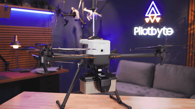
PilotByte’s Dylan Gorman Takes the TrueView 641 NDAA Into the Field for a Real-World Surveying Workflow

As more government agencies, engineering firms, and drone service providers face requirements for NDAA-compliant technology, one question continues to come up: Can an NDAA-compliant drone LiDAR system deliver the same performance and workflow professionals expect from the systems they already use?

GeoCue recently partnered with Dylan Gorman of PilotByte, along with Inspired Flight and Sentera, to put that question to the test. Instead of comparing specification sheets or flying another demonstration over an empty field, Dylan spent months testing the systems on actual projects with real clients and real deliverables.

For the LiDAR portion of the project, the centerpiece was the TrueView 641 from GeoCue.

Watch the video below to see if Dylan believes these NDAA-compliant systems actually hold up to the demands of professional work, or are there still compromises that need to be made:

TrueView 641 NDAA: Built for Real Surveying Work

Mounted to the Inspired Flight IF800, the TrueView 641 provided Dylan with a fully NDAA-compliant LiDAR and imaging payload designed for professional surveying and mapping.

The system combines long-range LiDAR with an integrated 26 MP global-shutter mapping camera, supports up to six returns, and delivers typical system accuracy in the 3–5 cm range under appropriate conditions. That ability to capture multiple returns becomes especially important when mapping areas with heavy vegetation, where the goal is not simply to capture the tops of trees, but to reach through the canopy and accurately model the ground below.

That capability was put to work on a real project with Florida Design Consultants. The site included significant vegetation and required data for a topographic survey supporting future design work. Dylan flew the TrueView 641 at approximately 70 meters and 7 meters per second, demonstrating the advantage of being able to collect accurate LiDAR data efficiently from a higher operating altitude.

The IF800 provided a capable NDAA-compliant aircraft platform for the project, with its Smart Dovetail integration allowing the TrueView 641 to mount directly to the aircraft and receive power through the platform. But just as important as the aircraft and sensor is what happens after the drone lands.

From Flight to Finished Deliverable in LP360

TrueView is more than a LiDAR sensor. The complete GeoCue workflow brings the sensor, positioning, processing software, and support together.

Dylan processed the TrueView 641 data directly in LP360, importing the raw mission, base-station observations, coordinate information, and control data into a single workflow. LP360 automatically recognized the TrueView sensor and provided the tools needed to process the trajectory, geocode the LiDAR, review the point cloud, and verify accuracy against surveyed control.

The results were impressive. Dylan reported vertical accuracy of less than one-tenth of a foot against the control point he examined. He then took the workflow another step using LP360 AI Ground+ to automatically classify the point cloud, allowing vegetation to be removed and the underlying surface to be quickly visualized.

From raw TrueView data to a processed and classified point cloud, Dylan estimated the workflow took about 30 minutes.

The Right NDAA LiDAR for the Job

The TrueView 641 NDAA is only one part of GeoCue’s expanding NDAA-compliant LiDAR portfolio.

GeoCue gives organizations the ability to select an NDAA-compliant LiDAR system based on their aircraft, accuracy requirements, project size, point-density needs, and budget.

That flexibility matters because there is no single sensor that is ideal for every project.

What Dylan’s testing demonstrates is that moving to an NDAA-compliant workflow does not mean giving up professional LiDAR performance. With the right combination of aircraft, TrueView hardware, LP360 processing, and GeoCue support, surveyors and mapping professionals can arrive on site, collect the data they need, process it efficiently, and confidently deliver results to their clients.

As Dylan summed it up after completing the projects: when a job is mission-critical, the system simply has to work. In this real-world test, the TrueView 641 helped do exactly that.

Categories
LiDAR Articles LiDAR News LiDAR Surveying & Mapping Software News

Candrone Joins GeoCue Global Distribution Network to Deliver TrueView LiDAR and LP360 Software Across Canada

Leading Canadian drone and remote sensing solutions provider expands access to GeoCue’s integrated LiDAR hardware and point cloud processing workflow

GeoCue, a leading provider of high-accuracy drone LiDAR mapping sensors and geospatial processing software, is pleased to welcome Candrone to its growing global distribution network, expanding access to TrueView LiDAR solutions and LP360 point cloud processing software throughout Canada.

With more than a decade of experience in drone and geospatial technology, Candrone helps organizations adopt and deploy enterprise-grade drone, sensor, and remote sensing solutions across demanding applications including surveying, mapping, forestry, mining, energy, and public safety. The company combines technology, training, services, and ongoing support to help customers successfully integrate drone solutions into their operations.

Through the new partnership, Candrone will provide Canadian customers with access to GeoCue’s portfolio of TrueView aerial, mobile, and handheld LiDAR solutions, along with LP360, GeoCue’s industry-leading point cloud processing software.

Andrew Fry, Sales Manager at Candrone, commented, “I’m looking forward to representing GeoCue and helping our customers find the right solutions for their drone LiDAR and data processing needs. GeoCue is a perfect fit for Candrone because TrueView and LP360 provide a complete, polished workflow from data capture through processing, classification, and final deliverables. Combined with GeoCue’s depth of LiDAR expertise and support, we’re confident this partnership will give our customers a powerful solution they can rely on.”

Candrone is now authorized to sell TrueView aerial, mobile, and handheld LiDAR products and LP360 3D point cloud imaging software from GeoCue.

For Candrone, the addition of GeoCue also provides customers with expanded access to NDAA-compliant LiDAR technology and an integrated hardware and software ecosystem. TrueView sensors and LP360 are designed to work together, helping reduce friction between field data collection and the production of accurate, actionable geospatial deliverables.

GeoCue’s TrueView LiDAR systems and LP360 software provide a streamlined workflow that helps professionals capture aerial, mobile, and handheld LiDAR data and create 3D point cloud deliverables faster, supported by training and responsive technical expertise. The partnership with Candrone further strengthens GeoCue’s ability to provide Canadian surveying, mapping, forestry, mining, and other geospatial professionals with local expertise and support.

Buck Baldwin, Channel Sales Manager at GeoCue, commented, “We’re excited to welcome Candrone to the GeoCue global distribution network. Their team brings extensive experience in drone technology, remote sensing, training, and customer support, along with a strong understanding of the applications our Canadian customers work in every day. Candrone’s solutions-focused approach makes them a great fit for GeoCue, and we look forward to working together to expand access to TrueView LiDAR and LP360 throughout Canada.”

With GeoCue’s full suite of LiDAR solutions now available through Candrone, customers across Canada will have expanded access to high-performance LiDAR technology, expert guidance, training, and an integrated processing workflow designed to help them move efficiently from data collection to finished deliverables.

About Candrone

Candrone is a Canadian drone and remote sensing solutions provider helping organizations solve complex operational challenges through enterprise-grade drone, sensor, and geospatial technologies. With more than a decade of industry experience, Candrone supports professionals across surveying and mapping, forestry, mining, energy, public safety, and other demanding applications.

Rather than simply providing hardware, Candrone works with customers to understand their operational challenges and combines the right technology, software, training, and support to deliver measurable results. From initial consultation and deployment through ongoing training and technical support, Candrone serves as a long-term partner for organizations building and expanding professional drone capabilities.

To learn more, visit www.candrone.com

Categories
LiDAR Articles LiDAR For Construction LiDAR For Engineering LiDAR For Utilities & Energy LiDAR News LiDAR Surveying & Mapping

GeoCue Announces TrueView LiDAR Payload Compatibility with Real-time Robotics Aerial Drone Platforms

New integration gives customers an NDAA-compliant aerial mapping solution backed by advanced UAS technology, TrueView LiDAR and LP360 software

GeoCue is pleased to announce that its TrueView LiDAR payloads are now compatible with aerial drone solutions from Real-time Robotics, Inc., expanding secure, NDAA-compliant options for customers who require high-performance LiDAR collection, aerial mapping and mission-ready UAS technology.

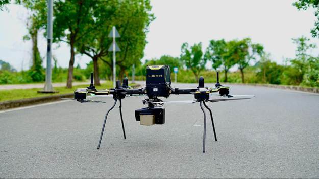
The Real-time Robotics HERA platform is a backpack-portable, NDAA-compliant aerial drone solution designed for rapid deployment, heavy-payload lifting and advanced multi-sensor missions, including GeoCue TrueView LiDAR collection.

Real-time Robotics designs and manufactures autonomous aerial systems for defense, public safety, commercial and critical infrastructure applications. The company’s platforms, including the HERA and VEGA systems, deliver a combination few comparable platforms can match: heavy-lift capacity, up to four simultaneous payloads, and backpack portability, deploying in under one minute and operating in harsh conditions that ground most tactical drones. Unlike manufacturers that outsource critical components, Real-time Robotics develops and builds its own airframes, avionics, motors, propellers, gimbals, flight controllers and smart battery systems in-house, ensuring high compliance standards, secure supply chain and field-proven performance across a wide range of missions.

The combined GeoCue and Real-time Robotics solution gives customers a powerful option for aerial LiDAR mapping with a secure drone platform, integrated TrueView payload technology and GeoCue’s LP360 software ecosystem for point cloud processing, visualization, classification and final deliverable creation.

The Real-time Robotics HERAplatform is an NDAA-compliant tactical heavy-lift UAS designed for industrial and advanced sensor operations, with a 30-pound payload capacity, up to 60 minutes of flight endurance and support for demanding LiDAR, ISR and multi-sensor missions. Paired with the system is the TrueView 641.

The complete Real-time Robotics Tactical Uncrewed Aircraft Platforms have also received Conditional Approval and exemption from the FCC Covered List, as announced by the FCC’s Public Safety and Homeland Security Bureau. This approval, granted through the federal review process, supports the ability to provide NDAA-compliant aerial solutions for customers and partners with special government, defense, public safety and critical infrastructure requirements.

“We’re excited to work with GeoCue and bring their cutting-edge, leading LiDAR technology to our customers,” said Ethan Khanh Vo, COO of Real-time Robotics, Inc. “Our customers need secure, mission-ready aerial systems that can support advanced sensor payloads and deliver reliable data in the field. By adding GeoCue TrueView compatibility to our platforms, we can offer a complete solution that brings together high-performance UAS technology, advanced LiDAR collection and the software tools needed to turn that data into actionable results.”

The GeoCue TrueView 641 is an NDAA-compliant aerial LiDAR payload built for high-accuracy mapping, engineering-grade point cloud collection and a complete workflow through LP360 software.

For GeoCue, the collaboration expands the company’s growing list of compatible NDAA-compliant drone platforms for TrueView LiDAR payloads. GeoCue’s TrueView portfolio is designed to support a range of aerial mapping needs, from entry-level survey and mapping projects to advanced engineering-grade LiDAR collection. When paired with LP360, customers gain a complete workflow from flight planning and data collection through processing, QA/QC, classification, visualization and deliverable generation.

“We are extremely pleased to support Real-time Robotics and add their NDAA-compliant aerial platforms to our list of compatible drones for TrueView LiDAR,” said Vincent Legrand, vice president of global sales at GeoCue. “This gives our customers another excellent option for a secure, NDAA-compliant drone and LiDAR solution that is fully capable of supporting demanding aerial mapping and LiDAR collection projects. Real-time Robotics brings strong innovation and mission-ready air platforms to the market, and GeoCue brings the LiDAR hardware, LP360 software, support and sales integrity that customers trust.”

GeoCue continues to set itself apart in the geospatial industry through its complete LiDAR ecosystem. The company offers an expanding portfolio of TrueView aerial and handheld LiDAR systems, LP360 software for LiDAR and imagery processing, expert technical support, training and a direct, honest sales approach focused on helping customers choose the right solution for their work.

Together, GeoCue and Real-Time Robotics are giving customers a secure, integrated aerial mapping solution designed for professionals who need dependable LiDAR data, NDAA compliance and a complete workflow from the field to final deliverable.

About Real-time Robotics, Inc.

Real-Time Robotics (RtR) is a US-based technology company that invents and builds unmanned systems for search and rescue, critical infrastructure, security, and defense. RtR’s UAV platforms, HERA and VEGA, deliver what few comparable platforms can achieve: heavy-lift capacity, four simultaneous payloads, and backpack portability. All systems are NDAA compliant and manufactured in-house.

Learn more at www.rtrobotics.com.

Categories
LiDAR Articles LiDAR For Construction LiDAR For Education LiDAR For Engineering LiDAR For Utilities & Energy LiDAR News Software News

GeoCue Welcomes Steel City Drones as New Distributor for TrueView and LP360 Solutions

Steel City Drones will offer GeoCue TrueView LiDAR systems and LP360 software to help drone professionals expand aerial mapping capabilities

GeoCue, a leading provider of drone mapping hardware, LiDAR sensors and geospatial processing software, is pleased to announce Steel City Drones as a new distributor of GeoCue TrueView LiDAR systems and LP360 software.

Founded in 2011, Steel City Drones has spent the last 15 years serving customers across the drone industry, including public safety, construction, surveying, energy and utilities, agriculture and inspection markets. The company supports customers throughout the continental United States and has built its business around product knowledge, hands-on training and responsive customer service.

Steel City Drones offers drone sales, training and ongoing support for individuals, teams and organizations looking to put drone technology to work in the field. The company’s approach is centered on long-term customer relationships that extend well beyond the initial purchase.

“Our mission has always been to help customers choose the right tools and then make sure they know how to use them successfully,” said David King, founder and CEO of Steel City Drones. “That is what makes this partnership with GeoCue so exciting. TrueView LiDAR systems and LP360 software give us reliable, reasonably priced solutions that can help our customers expand what they are able to do with their drones. We are looking forward to bringing these products to more construction, surveying, engineering and inspection professionals who need accurate data and a workflow they can trust.”

GeoCue’s TrueView product line combines drone LiDAR and imaging hardware with LP360 software, giving users a complete workflow from data collection through processing, analysis and final deliverables. As demand continues to grow for reliable aerial LiDAR, NDAA-compliant drone solutions and efficient geospatial software, Steel City Drones is well positioned to help customers evaluate and adopt the right technology for their work.

The partnership also supports GeoCue’s continued distributor growth across key U.S. markets.

“We are excited to grow our footprint with a great and reliable company like Steel City Drones,” said Vincent Legrand, vice president of global sales for GeoCue. “Their long history in the drone industry, along with their strong connections in public safety, construction, surveying, energy and utility, agriculture and inspections, make them a great partner for GeoCue. They understand their customers, they know the technology and they are committed to helping users succeed. That combination is exactly what we look for in a distributor as we continue to grow the aerial LiDAR market.”

According to Steel City Drones, customer feedback helped drive the decision to add GeoCue’s TrueView and LP360 solutions to its offering. The company also sees a strong need for dependable LiDAR options that are accessible to a wider range of professional users.

With TrueView LiDAR sensors and LP360 software, Steel City Drones customers will have access to an end-to-end solution designed for high-quality data collection, streamlined processing and practical deliverables. The technology is especially suited for construction, surveying and engineering firms looking to add or expand LiDAR capabilities.

Steel City Drones also brings a strong training focus to the partnership. The company provides support and instruction tailored to different customer needs, from basic drone operations to more specialized workflows for professional applications. Its team emphasizes hands-on learning, product testing and continued support to help customers get the most from their investment.

The addition of Steel City Drones strengthens GeoCue’s distributor network and expands access to TrueView and LP360 solutions for professionals looking to improve productivity, accuracy and confidence in their drone mapping workflows.

About Steel City Drones

Steel City Drones is a full-service drone company offering aerial production, drone sales, support, service and training. Founded in 2011, the company provides aerial video and photography, photogrammetry mapping services and professional drone solutions for customers across a range of industries. Steel City Drones helps customers select the right drone for their needs, set up their equipment and receive the flight training needed to operate with confidence. With thousands of logged flights, FAA certification and UAV-specific liability insurance, Steel City Drones brings proven experience and trusted support to every customer relationship.

For more information about Steel City Drones, visit steelcitydrones.com.

Categories
LiDAR Articles LiDAR Events LiDAR For Construction LiDAR For Education LiDAR News LiDAR Surveying & Mapping Software News

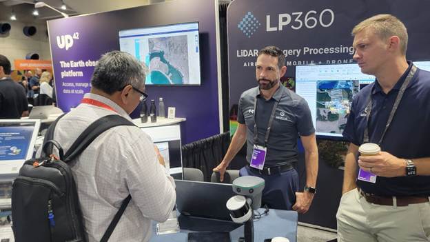
GeoCue Heads Back to the Esri User Conference to Showcase LP360

Visit Booth 227 in San Diego and join our Partner Presentation to see what’s new in LiDAR, imagery and 3D mapping workflows

GeoCue is heading back to San Diego for one of the biggest weeks in geospatial, and we’re bringing LP360 with us.

The Esri User Conference is always a highlight of the year for GIS professionals, mapping teams, surveyors, engineers, utilities, government agencies and anyone working with location-based data. It brings together thousands of people who are using GIS to solve real-world problems, share new ideas, explore new workflows and see what is next in geospatial technology.

This year, GeoCue will be exhibiting at Booth 227, where our team will be ready to meet with attendees, answer questions, demo LP360 software and show how we help geospatial professionals move from raw LiDAR and imagery data to accurate, actionable deliverables.

And yes, we are excited to be back.

For us, the Esri User Conference is a natural place to talk about LP360 because so many of our customers are not just collecting data for the sake of collecting data. They are collecting data because it needs to go somewhere. It needs to support decisions. It needs to become a map, a model, a report, a surface, a classification, a design input or a GIS layer that helps teams understand what is happening in the real world.

That is where LP360 comes in.

LP360 is the professional choice for geospatial data processing software. Built in the U.S.A. since 2006, LP360 helps professionals process drone, airborne, mobile and terrestrial LiDAR data, along with imagery, into accurate deliverables they can trust. Whether you are working with point cloud classification, QA/QC, 3D visualization, volumetrics, photogrammetry, surface creation or final output generation, LP360 gives you the tools to move faster and deliver with confidence.

At Booth 227, attendees will be able to see LP360 in action and learn how our software supports the full data workflow. We will be showing new features and tools, answering processing questions and helping users better understand how to get more from their LiDAR and imagery data.

GeoCue will also be hosting a 30-minute Partner Presentation, “New in LP360: LiDAR, Imagery & 3D Mapping Workflows,” taking  place on Wednesday, July 15, 2026, from 4:00–4:30 PM at the Expo Partner Presentation Theater in Hall A.

This session will give attendees a closer look at the latest updates in LP360, including new tools and workflows designed to help geospatial professionals process data faster, improve point cloud classification, create better deliverables and get more value from both LiDAR and imagery.

We’ll cover recent enhancements including expanded sensor support, improved photo and colorization tools, AI-assisted classification options, 3D visualization capabilities and workflow updates that make it easier to move from raw data to final deliverables inside LP360.

If you want a quick, practical look at what is new and how LP360 is continuing to evolve for modern geospatial workflows, this will be a great session to attend.

One of the key reasons LP360 matters to the Esri community is simple: your data should not get stuck in processing.

For GIS teams, the value of LiDAR and imagery is not just in the point cloud. The value is in what you can do with it next. LP360 helps users create outputs that can support Esri workflows, including point cloud files, shapefiles, raster surfaces, elevation products, imagery outputs and other deliverables that can move into GIS environments for analysis, visualization and decision-making.

That is important because so many organizations rely on Esri software as the central hub for their mapping and geospatial operations. Cities use it to manage infrastructure. Utilities use it to monitor assets and rights of way. Engineering firms use it to support design and documentation. Public safety teams use it for planning and response. Survey and mapping professionals use it to deliver accurate data that their clients can actually use.

We are also seeing this workflow become especially important in school safety and emergency response mapping.

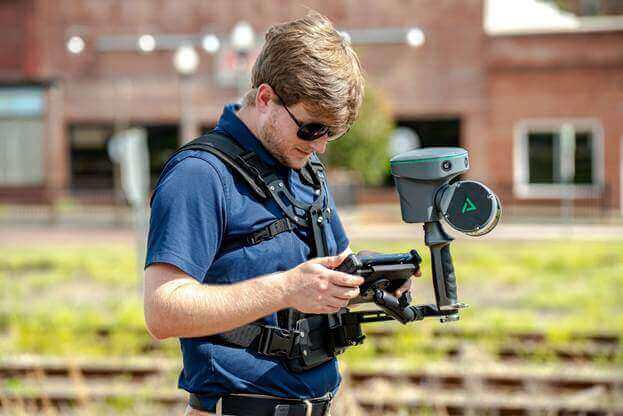
Across the country, more schools are being mapped with handheld LiDAR systems like the TrueView GO to quickly capture accurate interior and exterior conditions. Hallways, entrances, stairwells, classrooms, gymnasiums, utility areas and campus surroundings can all be documented in detail without relying on outdated drawings or manual measurements.

Once that data is processed in LP360, it can be cleaned, classified, reviewed and exported into Esri software to support final GIS deliverables. For school districts, public safety teams and first responders, that means better safety maps, more accurate facility documentation and a clearer understanding of the spaces they may need to navigate during an emergency.

That is a powerful example of why the connection between field collection, LP360 processing and Esri-ready outputs matters. The data does not just look impressive on screen. It becomes something useful, shareable and actionable for the people who need it most.

LP360 helps bridge the gap between data collection and GIS-ready deliverables.

With today’s sensors, it is easier than ever to collect large amounts of data. Drone LiDAR, handheld SLAM, mobile mapping and advanced imagery systems can capture incredible detail in a short amount of time. But once the field work is done, the real question becomes: how do you process it, validate it, classify it and turn it into something useful?

That is exactly the conversation we want to have at Esri UC.

Our team will be available throughout the show to walk attendees through LP360 workflows, including how to process LiDAR and imagery, classify point clouds, inspect results, create surfaces, generate deliverables and prepare data for use across GIS and mapping workflows. Whether you are new to LiDAR or already managing large-scale datasets, we can help you understand where LP360 fits into your process.

We are especially looking forward to connecting with GIS professionals who are working with more 3D data, more reality capture tools and more demanding deliverable requirements. As the industry continues to move toward faster collection, better visualization and more integrated geospatial workflows, software like LP360 plays an important role in helping teams keep up.

The Esri User Conference is the perfect place to have those conversations.

If you are attending the conference, stop by Booth 227 and meet the GeoCue team. See what is new in LP360, ask us your processing questions and learn how we can help you turn LiDAR and imagery data into the deliverables your GIS teams need.

And make sure to join us for our 30-minute Partner Presentation, “New in LP360: LiDAR, Imagery & 3D Mapping Workflows,” on Wednesday, July 15, from 4:00–4:30 PM at the Expo Partner Presentation Theater in Hall A for a closer look at the latest LP360 updates and how they can help improve your LiDAR, imagery and 3D mapping workflows.

We look forward to seeing you in San Diego.

Categories
LiDAR Articles LiDAR News Software News

Celebrate 20 Years of LP360 Software: The Professional Choice in Geospatial Data Processing

Twenty years is a long time in any technology market. In LiDAR and imagery software, it is practically a lifetime.

Since 2006, LP360 has been helping geospatial professionals turn massive, complex point cloud datasets into accurate, usable deliverables. That’s worth celebrating! In an industry where sensors change, workflows evolve, file sizes continue to expand, and customer expectations keep getting higher, LP360 has continued to do what it was built to do from the beginning: make LiDAR data easier to process, easier to understand, and easier to deliver with confidence.

LP360 began its journey in the early days of professional LiDAR adoption, when point cloud data was becoming more common but still difficult for many GIS and mapping professionals to work with efficiently. Originally developed by QCoherent, LP360 was introduced as a LiDAR extension for ArcGIS, giving users a way to access, view, and work directly with LAS files inside a familiar GIS environment. That sounds simple today, but in 2006, it was a big deal.

At the time, LiDAR datasets were already large, difficult to manage, and often required users to create multiple derivative products just to make the data practical to use. LP360 helped change that by allowing users to interact with the point cloud itself. Early features included direct LAS access, cross-section exports, an embedded 3D viewer, and tools designed to bring LiDAR into the GIS world in a more practical way.

That original idea still matters today.

Because even with all the advances in sensors, drones, mobile mapping systems, SLAM scanners, cloud processing, and AI, the goal is still the same: take the data you collected in the field and turn it into something accurate, useful, and ready for the customer.

In 2009, GeoCue acquired QCoherent, bringing LP360 into the GeoCue family. Since then, LP360 has continued to grow from a powerful LiDAR viewing platform into a complete processing environment for drone, airborne, mobile, and terrestrial LiDAR and imagery workflows. What started as a way to make LiDAR easier to use in GIS has become a professional software platform used across surveying, engineering, utilities, construction, mining, forestry, transportation, and mapping applications.

And through all that growth, LP360 has remained proudly made in the U.S.A.

Today, LP360 gives geospatial professionals the tools they need to move from raw data to final deliverables in one streamlined environment. Users can process point clouds, classify data, perform QA/QC, review accuracy, generate surfaces and contours, calculate volumes, visualize data in 2D and 3D, extract features, colorize point clouds, work with imagery, and prepare outputs for clients and downstream software.

For surveyors, that means confidence in the data before it leaves the office. For engineers, it means better surfaces, cleaner deliverables, and easier analysis. For construction teams, it means stockpile measurements, cut/fill volumes, and site documentation that can be trusted. For utilities, it means tools that help pull more value from complex corridor and infrastructure datasets. For mapping professionals, it means the flexibility to work with data from multiple sensors and platforms without constantly jumping between disconnected software packages.

That flexibility has become one of LP360’s biggest strengths.

The geospatial industry is no longer built around one type of sensor or one type of workflow. A single company might be processing UAV LiDAR one day, mobile data the next, and handheld SLAM scans after that. Imagery is now part of the conversation, too. Customers do not just want point clouds. They want orthomosaics, colorized data, 3D models, contours, surfaces, reports, and deliverables that help them make decisions.

LP360 has continued to evolve to meet that reality.

Recent updates have focused heavily on making workflows more intuitive and more connected. New ribbon-based tools, improved processing tabs, and guided workflows help users get to the right tools faster. The Volume tab, for example, makes it easier to manage cut/fill calculations, stockpile measurements, and terrain-based volume computations. These are the kinds of everyday workflow improvements that matter when you are trying to get real project work out the door.

The new 3D Photo Engine is another major step forward. It brings photogrammetry and LiDAR-enhanced imagery workflows into a more integrated experience, allowing users to generate products such as orthomosaics, colorized point clouds, and 3D mesh outputs through a guided interface. As LiDAR and imagery become more connected, LP360 is making it easier to process both together instead of treating them as separate worlds.

And of course, one of the biggest developments this year is AI Classification.

LP360’s AI Classification tools are designed to reduce the manual effort required to classify point cloud data and help users move faster from raw data to usable results. AI Ground Classification gives users a way to classify ground points using a pre-trained deep learning model without building their own training datasets. That is especially important because, for many LiDAR projects, the ground surface is the main deliverable. Getting to a better ground surface faster can have a major impact on the entire workflow.

LP360 has also expanded into additional AI tools, including AI Ground+, AI Forestry, and AI Utilities. These tools are part of a broader effort to help users classify more than just ground points, with workflows designed around vegetation, buildings, utilities, forestry features, and infrastructure data. It is not about replacing the professional. It is about giving the professional a faster starting point, better automation, and more time to focus on quality, review, and final deliverables.

That is really the story of LP360 after 20 years.

It has never been about chasing technology for the sake of technology. It has been about helping geospatial professionals do their work better. From the early days of bringing LiDAR into GIS, to today’s cloud-based AI classification, integrated imagery workflows, 3D visualization, volumetrics, QA/QC, and advanced deliverable creation, LP360 continues to evolve with the needs of the industry.

Twenty years later, LP360 is still here, still improving, and still focused on the same mission: making LiDAR and imagery processing easier, faster, and more reliable for the professionals who depend on it every day.

Here’s to 20 years of LP360, and to the next generation of geospatial workflows still to come!