Categories
LiDAR Articles LiDAR Events LiDAR For Education LiDAR For Engineering LiDAR For Utilities & Energy LiDAR News LiDAR Training

GeoCue’s Thadeu Lugarini to Lead LiDAR Reality Capture Course at DroneShow and MundoGEO Connect 2026

GeoCue Customer Success Specialist Thadeu Lugarini will share practical LiDAR reality capture workflows, AI processing insights, and real-world applications at DroneShow and MundoGEO Connect 2026.

GeoCue is excited to share that Thadeu Lugarini, UAS Service Technician • Customer Success for GeoCue, will be leading a special course on LiDAR in Reality Capture at DroneShow and MundoGEO Connect 2026, taking place June 16–18, 2026, at Expo Center Norte – Blue Pavilion in São Paulo, Brazil.

The course will be part of the larger MundoGEO Connect 2026 program, held in parallel with DroneShow, SpaceBR Show, and Expo eVTOL. These events bring together geospatial professionals, drone operators, engineers, technology providers, and industry experts to explore the latest innovations shaping the future of mapping, reality capture, infrastructure inspection, environmental monitoring, and advanced geospatial workflows.

For GeoCue and LP360 users, this session is a great opportunity to take a deeper look at how LiDAR is being used in real-world reality capture projects from the field to final deliverables.

A Practical Look at LiDAR for Reality Capture

The LiDAR in Reality Capture course will provide an overview of LiDAR technology and how it is being applied across today’s most important geospatial workflows. Thadeu will cover the fundamentals of LiDAR, including how the technology works, where it fits into modern mapping projects, and why it has become such an important tool for engineering, infrastructure, forestry, environmental, and inspection applications.

The session will also explore the main ways LiDAR data is collected, including airborne LiDAR, mobile mapping systems, and SLAM-based handheld LiDAR. This is an important topic as more professionals look for flexible reality capture solutions that can support work from the air, on the road, and on foot.

As part of the course, attendees will learn more about mission planning, data acquisition, point cloud generation, data import into processing software, and product generation. Thadeu will also cover practical post-processing techniques used to optimize point clouds and create stronger final deliverables.

Bringing GeoCue and LP360 Experience to the Classroom

One of the most valuable parts of this course will be the practical perspective Thadeu brings from his work with GeoCue customers and applied LiDAR projects. As part of GeoCue’s Customer Success team, Thadeu works directly with users to support LiDAR workflows, develop processing strategies, and help customers get the most out of their data.

That hands-on experience will help shape the course content, with real-world examples and practical lessons from the field. Attendees can expect a session that goes beyond theory and focuses on how LiDAR is actually being used to solve project challenges, improve efficiency, and create better geospatial deliverables.

The course will also include discussion around newer visualization and processing techniques, including 3D modeling meshes and Gaussian Splatting, both of which are becoming increasingly important as reality capture continues to evolve.

AI and the Future of LiDAR Processing

Another key focus of the course will be the growing role of Artificial Intelligence in LiDAR production workflows. AI is helping geospatial professionals become more efficient by supporting tasks such as automatic classification, feature extraction, vectorization, and other processing steps that traditionally required significant manual effort.

This is an area where GeoCue and LP360 continue to invest heavily. With advanced AI classification tools available in LP360, users can accelerate common production workflows and generate more useful outputs from their LiDAR point clouds. The course will provide attendees with a look at how these technologies are being applied and why they are becoming such an important part of modern geospatial data processing.

About the Instructor

Thadeu Lugarini is a Civil Engineer and geotechnology specialist who serves as UAS Service Technician • Customer Success for GeoCue. He has experience in point cloud processing, photogrammetry, GNSS, LiDAR workflows, and geospatial applications for engineering, infrastructure, and environmental projects.

In 2026, Thadeu presented papers to the American Society for Photogrammetry and Remote Sensing (ASPRS) during Geo Week 2026 in Denver, sharing practical applications and lessons learned from LiDAR-based projects.

Join the Course in São Paulo

The LiDAR in Reality Capture course will take place during DroneShow and MundoGEO Connect 2026, from June 16–18, 2026, in São Paulo. By registering for at least one activity, such as a course, seminar, or forum, attendees will receive admission to all three days of the trade show.

Early registration is open, with a 10% discount available until May 29, and spaces are limited.

For anyone looking to better understand how LiDAR, AI, and modern reality capture workflows are coming together, this course offers a great opportunity to learn from practical experience and see how GeoCue technologies are helping professionals move from data collection to deliverables with confidence.
Categories
LiDAR Articles LiDAR News LiDAR Training Software News

How to Collect and Process Data with TrueView LiDAR and LP360 Software

Watch our online training videos to learn the most efficient workflow for processing LiDAR data in LP360.

If you are looking to improve your workflow with TrueView LiDAR and LP360 software, GeoCue now makes it easier than ever to learn the complete process, from mission planning and data collection to point cloud refinement and final deliverables.

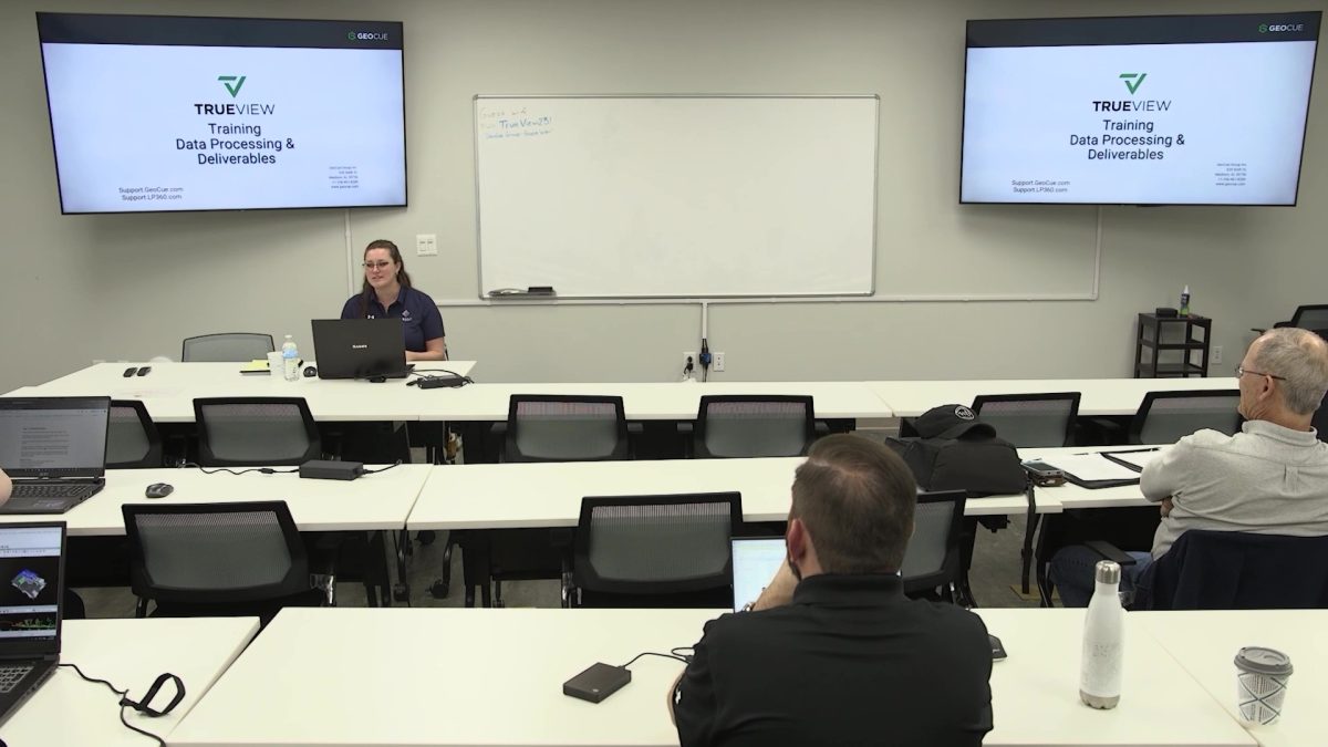
To help users build confidence and solve issues faster, we have recorded sessions from our in-house TrueView Training workshop at GeoCue Headquarters in Huntsville, Alabama, and made them available on YouTube. Each video includes timestamps, so you can quickly jump to the exact workflow step, tool, or topic you need help with.

Whether you are new to LiDAR or already working with advanced drone mapping projects, these on-demand training videos are designed to help you better understand best practices for collecting, processing, classifying, and exporting high-quality LiDAR data.

GeoCue also offers structured training courses for all of our software and hardware solutions, covering a broad range of LiDAR mapping workflows. Regardless of your organization’s experience level, we will work with you to develop a training plan that helps your staff become more efficient with drone mapping tools while improving their understanding of LiDAR data processing.

In addition to teaching specific tools and techniques, our training also covers the underlying mapping methods, as well as industry best practices and proven procedures. Our team can provide training either virtually or in person, depending on your preference.

Every month, we offer a FREE 2-day training workshop at our Huntsville, Alabama office, and anyone can sign up online—whether you are already a customer or simply interested in learning more. With the right technology, drone-mounted LiDAR systems can dramatically improve efficiency on mapping applications by reducing the time it takes to collect and process data.

During this free 2-day workshop, we explore the best practices for drone mapping, including the hardware and software components needed to successfully complete projects.

What You’ll Learn in the Free 2-Day Workshop:

Day 1: Flight Operations and Preliminary Data Processing

  • How to maximize flight plans
  • Drone and sensor components and how they affect final collections
  • Best practices for high-accuracy collection
  • How field QA/QC saves time and money

Day 2: Ground Classification and Derivative Products

  • Adaptive TIN Algorithm – what you need to know
  • Working with Point Cloud Tasks (PCTs)
  • Accuracy assessment, de-bias, and dealing with noise
  • Data smoothing
  • Automatic ground classification
  • Ground class cleanup and manual editing tools
  • Classification strategies, additional tools, and macros
  • Data thinning
  • Using the Export Wizard

If you are unable to attend an in-person event, be sure to check out our virtual training options available in North America and Europe.

Watch the TrueView Training Videos On Demand

Below are recorded sessions from our in-house training workshop. These videos are conveniently hosted on YouTube with timestamps, making it easy to navigate directly to the workflow step, tool, or challenge you need help with.

Video 1: LP360 Workflow After Data Collection

Watch here:

In this Day 1, Session 2 TrueView training from GeoCue Headquarters in Huntsville, Alabama, Eian Davis walks through the essential LP360 workflow after data collection. The session covers how to configure project settings, check out licenses, set up working directories and archives, import and archive flight data, define coordinate systems, create and edit flight lines, run QC-only trajectory processing, inspect geocoded point cloud coverage, perform strip alignment, import control points, and review accuracy estimation results.

This is a valuable hands-on training for LP360 and TrueView users who want to build confidence in data quality checks and prepare for refined processing and deliverables.

Video 2: Hands-On LP360 Project Setup and Preparation

Watch here:

In Day 2, Session 2 of GeoCue’s TrueView training at Headquarters in Huntsville, Alabama, Eian Davis leads a hands-on LP360 exercise focused on setup verification and project preparation before processing. The session reviews License Manager settings, default project folders, notification email setup, Archive Manager workflows, copying and moving archived flights, importing cycles from the archive, bringing in ancillary and base station files, selecting the correct coordinate system, and beginning flight line creation.

This session is a useful practical walkthrough for both new and experienced users who want to streamline project setup, reduce errors, and avoid common issues before processing drone LiDAR data.

Video 3: LP360 Data Processing and Deliverables

Watch here:

In Day 2, Session 1 of GeoCue’s TrueView training at Headquarters in Huntsville, Alabama, Eian Davis covers the complete LP360 data processing and deliverables workflow for drone LiDAR projects. Topics include file path best practices, flight line setup, trajectory and geocoding review, strip alignment, surface precision assessment, point cloud cleanup, smoothing, noise filtering, adaptive ground classification, assisted cleanup, accuracy estimation and de-bias, plus exporting key deliverables such as DEMs, contours, orthomosaics, and LandXML.

This is a highly valuable session for users who want a broader understanding of how raw TrueView collections move through LP360 into clean, accurate, client-ready deliverables.

Video 4: Mission Planning and Flight Operations with TrueView LiDAR

Watch here:

Join GeoCue Support Technician Eian Davis for Day 1 of our training workshop—recorded at GeoCue Headquarters—focused on mission planning and safe, repeatable flight operations with TrueView LiDAR payloads. This session covers a practical hardware overview, including TrueView payload options, mounting, storage, and USB best practices, along with PPK base station requirements and processing options such as Single Base, SmartBase, and PP-RTX.

Eian also reviews control point and target strategies for accurate results, including 2D targets and the Accuracy Star, before walking through mission-planning parameters such as line spacing, altitude, scan angle, side lap, and planning around vertical objects to avoid data gaps. Additional topics include using GeoCue’s mission planning spreadsheet, DJI Pilot 2, the TrueView Web UI, payload settings, safety checks, heading alignment, and field QA/QC procedures.

This session is an excellent starting point for users who want to improve collection consistency and avoid common field mistakes before they impact processing.

Video 5: Classification Workflows and Deliverable Generation

Watch here:

In Day 2, Session 3 of GeoCue’s TrueView training, Eian Davis walks through the next phase of LP360 data refinement by focusing on classification workflows and deliverable generation. The session covers assigning and launching the AI Ground Classifier, comparing Agisoft ortho quality to standard RGB map output, smoothing the point cloud, removing noise with the Outliers tool, building a seed surface, running adaptive ground classification iterations, comparing AI and manual classification results, using manual and assisted cleanup tools, checking results with Surface Precision, and creating practical outputs such as thinned ground LAS, DEMs, gridded LAZ files, contours, and cloud-ready deliverables.

It is a practical hands-on session for LP360 users who want to improve ground models, create cleaner final mapping products, and better understand the classification tools available inside LP360.

Learn On Demand or Train with Us in Person

These recorded training sessions are a great way to learn at your own pace and get more value from your TrueView LiDAR system and LP360 software. Whether you need help solving a specific issue, improving your processing workflow, or understanding best practices from the field to final deliverable, these videos are designed to provide useful, practical guidance.

We hope these instructional videos can provide you with the support you need to get the most out of LP360 software. Our support team is always standing by to further assist, and you can always reach out at support@geocue.com.

Categories
LiDAR Articles LiDAR For Construction LiDAR News LiDAR Training Software News

How to Easily Calculate Volumetrics with LiDAR in LP360: Meet the New Volumes Ribbon

Calculate cut and fill volumes faster with the improved LP360 Volumes Ribbon, using LiDAR point clouds for accurate stockpile and terrain volumetrics.

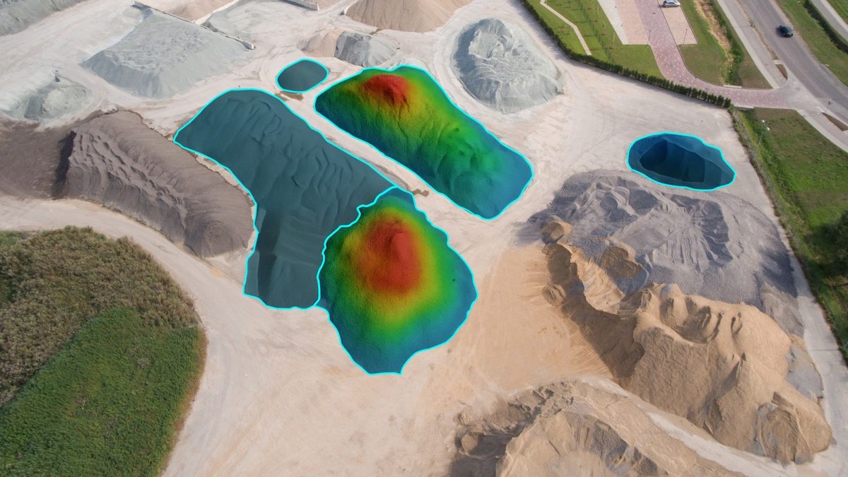
If you work with stockpiles, cut and fill, site grading, or terrain change, you already know the goal: get a clean, repeatable volume answer without fighting your workflow. One of the latest LP360 updates delivers exactly that with the new and improved Volumes Ribbon in the Volumes tab, built to streamline volumetric analysis from start to finish.

The New Volumes Ribon in LP360

To help you get up to speed quickly, we created a short walkthrough video titled “How to Easily Calculate Volumetrics with LiDAR in LP360.” This video is designed to be a practical, click-by-click overview to help you use the Volumetrics Ribbon.

License note: Volumetric tools require LP360 Geospatial Standard and above, LP360 Drone, or LP360 Land Standard.

What the Volumes Ribbon is built to do

The Volumes Ribbon is a dedicated set of tools for volumetric analysis using LiDAR point clouds. It’s designed for common real world workflows like:

  • Stockpile volumes
  • Cut and fill volumes
  • Terrain and surface comparisons
  • Fast volume checks for mining, construction, and land development

Instead of jumping between menus or piecing together a process, the Volumes Ribbon gathers the key commands and settings into one place so you can define your area, set your analysis rules, run the calculation, and manage outputs with fewer steps.

The core of the update: the Compute Volumes dialog

The centerpiece of the Volumes tab is the Compute Volumes dialog, introduced in LP360 version 2025.2. This is where the workflow really tightens up.

With the Compute Volumes dialog you can:

  • Define the basic settings for the Volumetric Analysis Point Cloud Task
  • Run volume calculations on your active LAS and selected feature layers
  • Automatically set Output Volume Units based on the unit system of the active LAS layer
  • Choose where results go using the Volumes Layer dropdown

You can append results to an existing feature layer or create a new one. In practice, this makes it much easier to keep projects organized, especially when you are running multiple piles or multiple phases of the same site.

Bringing in your areas of interest: Import Area Features

The Import Area Features command has also been improved to keep you focused and reduce mistakes.

Enhancements include:

  • The Add Files dialog now shows only the Features tab
  • Imports are restricted to 3D polygons so the geometry is compatible with volumetric analysis tasks

This matters because volume results are only as reliable as the boundary you give them. Restricting imports to the right feature types helps avoid those frustrating “why didn’t it run” moments.

Dialing in the analysis: Volumetric Analysis Properties

Once you have your area defined, LP360 gives you clear property pages to control the surfaces being compared and what outputs you want to generate.

Key property pages include:

Hull Property Page

Defines the upper surface boundary using LAS points, polygon vertices, or a constant elevation.

Base Property Page

Sets the lower surface for comparison.

Volume Property Page

Controls output location and attributes like total volume, cut, fill, and surface statistics.

Cut and Fill Image Page

Lets you generate a visual cut and fill output for quick review and reporting.

LAS Output Page

Controls optional LAS file outputs, when you need them for downstream workflows.

This combination gives you both precision and flexibility, whether you are calculating a simple stockpile or validating a more complex earthwork surface.

Need a fast answer: the Quick Compute Volume Tool

Sometimes you do not need a fully customized setup. You just need a quick volume check.

The Quick Compute Volume tool is built for that. It lets you:

  • Digitize a polygon directly on the map
  • Run a predefined volumetric analysis using typical settings
  • Generate output shapefiles and cut and fill images with minimal setup

For many users, this becomes the fastest way to sanity check volumes before running a more formal report.

Best practices for consistent results

A few habits will keep your volumetrics workflow smooth and repeatable:

  • Confirm the Active LAS Layer before you run Compute Volumes
  • Verify your project coordinate system and units early, especially when mixing datasets
  • Use the Volumes Layer dropdown intentionally, append when you want a running record, create new layers when you want clean separation between scenarios

Quick troubleshooting tips

If something does not look right, these are the first places to check:

  • Volumes tab missing: Confirm your license includes volumetric tools
  • Output files not appearing or misnamed: Review the Volume Property Page settings and ensure Add to Map is selected
  • Digitized Input macro not behaving as expected: Confirm the Project Path is set and your polygon is properly digitized

Wrap up

The updated Volumes Ribbon in LP360 makes volumetric analysis faster to set up, easier to manage, and more consistent across projects. Pair it with the video walkthrough, and you will be calculating cut and fill and stockpile volumes with a workflow that feels purpose built.

Categories
LiDAR Events LiDAR For Education LiDAR News LiDAR Surveying & Mapping LiDAR Training

Register for the 2026 LP360 User Conference

Save the Dates: October 20 – 22, 2026

We know it’s early, but we want to make sure everyone has plenty of time to mark your calendars and plan to join us for another can’t-miss week of learning, training, and real-world takeaways with LP360. The dates for this year’s conference are October 20 – 22, 2026.

New for 2026: we’re kicking things off on a Tuesday.

That means you can spend the heart of your week with the best in the business, Tuesday, Wednesday, and Thursday, with 3 full days of training, presentations, featured talks, and hands-on learning designed to help you get more from LP360 and deliver your best work.

Registration is now open — secure your spot today! Use the Promo Code “LP360” to save $100 per registration: https://www.lp360.com/resources/2026-lp360-user-conference/

Whether you’re a long-time LP360 power user or attending for the first time, this is your chance to:

  • Learn what’s new (and what’s next) in LP360
  • Pick up practical tips you can apply immediately
  • Connect with other LiDAR and photogrammetry pros
  • Spend three focused days improving your workflows and deliverables

Hotel Accommodations:

Once again, we’ve made your stay more convenient by reserving a block of rooms at the Huntsville Marriott at the Space & Rocket Center, right across the street from our conference! We have a limited number of rooms available, so book early!

Huntsville Marriott at the Space & Rocket Center

5 Tranquility Base

Huntsville, AL 35805

T: 256.830.2222

Use Group Code GEO for special rates.

LP360 Dinner Reception (Wednesday – Day 2)

One of the best parts of the conference is still the LP360 Dinner Reception, happening on Wednesday night (Day 2) at the Davidson Center for Space Exploration. You’ll get to network with fellow attendees while dining beneath an authentic Saturn V Apollo moon rocket, a National Historic Landmark, surrounded by incredible space artifacts and interactive exhibits. It’s a memorable night that makes the conference experience even better.

Mark your calendar now! More details coming soon.

See you in Huntsville in October!

Categories
LiDAR Articles LiDAR Events LiDAR For Education LiDAR News LiDAR Training Software News

LP360 2025 Conference Recordings: LiDAR Processing Tips, QA QC, and Best Practices

Learn from the Experts: On-Demand Sessions from the LP360 User Conference

The 2025 LP360 User Conference brought together geospatial professionals, innovators, and LP360 power users for a mix of training, presentations, and real-world success stories. If you couldn’t join us in person, or you want to rewatch a favorite session, the recordings are now available online.

These on-demand videos are packed with practical tips, expert guidance, and proven techniques you can put to work right away to get even more out of LP360. Click the link above to access our online video library for the LP360 2025 User Conference training sessions and presentation recordings.

Presentations:

How to do Ground Classification in LP360

Presented by Eian Davis

How to Process Handheld Lidar with LP360

Presented by Stanford Marquis

How to Export LP360 Products to CAD Software

Presented by Matt Stevens

How to QA QC in LP360

Presented by Eian Davis

How to Use the new Ground Clean Up Tools in LP360

Presented by Eian Davis

Introduction to Breaklines in LP360

Presented by Matthew Stevens

Lidar Data Preparation for Autodesk Civil 3D Design

Presented by Michael Carlson

How to Create Powerful Media Strategies for Point Clouds

Presented by Francisco Gonzales

Integrating Lidar and Bathymetric Data in LP360

Presented by Thadeu Lugarini

Categories
LiDAR Events LiDAR For Construction LiDAR For Education LiDAR For Engineering LiDAR For Utilities & Energy LiDAR News LiDAR Surveying & Mapping LiDAR Training

The TrueView GO Road Show Rolls Into Birmingham

GeoCue and Earl Dudley kick off the TrueView GO Road Show at Birmingham’s historic Sloss Furnaces

GeoCue is hitting the road, and we’re bringing handheld LiDAR technology to you! Throughout the coming months, we’ll be partnering with our network of GeoCue distributors across the United States to host a series of TrueView GO Road Shows, giving professionals everywhere the chance to see the power of the TrueView GO handheld LiDAR in action.

We’re kicking off the first stop of the tour with our distribution partner, Earl Dudley, Inc., in Birmingham, Alabama, on Wednesday, November 19, 2025, from 10 a.m. to 3 p.m. at the historic Sloss Furnaces. Stay tuned for details on where we’ll be stopping next because the TrueView GO Road Show may be coming to your neck of the woods!

A Landmark Setting for Scanning

The Sloss Furnaces is a National Historic Landmark and one of Birmingham’s most iconic industrial sites. From 1882 to 1971, it operated as a pig iron-producing blast furnace and later became one of the first industrial locations in the U.S. to be preserved and restored for public use. Its towering stacks and weathered steel make it the perfect setting to showcase modern mapping technology that’s transforming the way we capture and preserve our world.

During the event, we’ll create an incredible 3D scan of the historic Sloss Furnaces, demonstrating the power and precision of the TrueView GO handheld LiDAR system. You’ll be able to view and explore the scan in LP360 Land, GeoCue’s powerful LiDAR and imagery processing software.

Experience Handheld LiDAR in Action

This one-day event is your opportunity to see, touch, and try the TrueView GO, the handheld LiDARand SLAM system from GeoCue. Designed for versatility and simplicity, the TrueView GO combines GNSS RTK surveying with SLAM-based 3D reality capture, making it ideal for mapping both indoor and outdoor environments.

With the TrueView GO, complex scanning tasks become as easy as walking through your site. Whether you’re mapping a building, forest, tunnel, or construction zone, this lightweight and cable-free device delivers the flexibility and accuracy professionals need for reliable results.

The TrueView GO is available in two models: GO 116S and GO 132S, both equipped to handle challenging environments, even where GNSS signals are limited. From civil engineering and architecture to forensics, forestry, and facility management, TrueView GO is redefining handheld LiDAR workflows.

Trueview Go and Tablet

What to Expect

10:00 a.m. – Welcome and Overview

10:30 a.m. – TrueView GO Overview

11:00 a.m. – Live Scanning Demonstration

12:00 p.m. – Lunch (provided)

1:00 p.m. – 3D Data Processing and Presentation

2:00 p.m. – Q&A and Closing Remarks

During the 3D processing session, you’ll see firsthand how LP360 software makes it easy to process, colorize, and quality-check your data. LP360 Land is the core product for processing mapping data from the TrueView GO. Maximize your handheld LiDAR and SLAM data with visualization, QA/QC, classification, 3D editing, and analysis capabilities. It includes the features below:

  • Intuitive workflow
  • Multi-scan import and processing
  • GIS interface allowing combination with other geospatial data
  • Powerful point cloud visualization with multiple and synchronized windows: 2D, 3D, profile and immersive synchronized windows.

Why Attend

-Get hands-on experience with TrueView GO and LP360.

-Learn from GeoCue and Earl Dudley experts.

-See a 3D scan of a National Historic Landmark.

-Network with peers in surveying, AEC, and geospatial industries.

-Enjoy complimentary lunch and interactive demos.

Register Today

Space is limited! Reserve your seat now at: lp.geocue.com/trueview-go-road-show-birmingham-2025

We can’t wait to see you in Birmingham for the kickoff of our TrueView GO Road Show and we’ll be announcing more stops soon. Stay tuned, because the next one might be near you!

Categories
LiDAR Articles LiDAR For Education LiDAR News LiDAR Training Software News

LP360 Quick Sheets: Your Go-To Reference for Smarter Workflows

Download LP360 Quick Sheets to Support your LiDAR and Imagery Processing

During our recent LP360 User Conference, we introduced a new set of LP360 Quick Sheets: concise, easy-to-follow resources designed to help you get the most out of your favorite LP360 features. These handy one-pagers quickly became a conference favorite, giving users step-by-step workflows, helpful visuals, and time-saving tips to make daily LiDAR and imagery processing even more efficient.

Now, we’re making them available online so everyone can take advantage of them! Whether you’re refining your point cloud classification, working with imagery, or exploring new tools, the LP360 Quick Sheets are the perfect reference to keep at your desk or in the field.

Browse and download the LP360 Quick Sheets below to elevate your workflow.

1. Auto AI Ground Classification

This Quick Sheet explains how to use LP360’s AI Ground Classification Add-On, a cloud-based deep learning model that automatically classifies ground and non-ground points within a point cloud. It highlights setup requirements, advantages over traditional methods, and optional preprocessing parameters like outlier detection, smoothing, and tiling for improved results.

2. Building Extraction in LP360

This guide walks through the Building Extraction workflow using LP360’s Point Cloud Tasks (PCTs). It covers thinning the dataset, ground classification, running the Building Filter, and applying the Building Extractor to create building polygons. It also includes tips for processing dense datasets and reviewing results in Feature Analyst.

3. Ground Cleanup Tool

This Quick Sheet details how to use the Ground Cleanup Tool to refine and correct areas missed during initial ground classification. It explains both manual and assisted cleanup modes, execution methods (by layer, polygon, or feature), and cleanup intensity options. The tool integrates with LP360’s AI Ground Classification workflow to deliver more accurate terrain models.

4. Immersive Image Explorer

This sheet introduces the Immersive Image Explorer, a feature within the LP360 Immersive Viewer that provides a street-level view of point cloud data synchronized with imagery. It explains how to navigate between geo images and street-view images, toggle visual layers, and inspect data interactively for immersive inspection and analysis.

5. Powerline Extraction in LP360

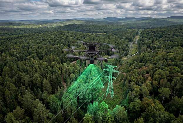
This guide outlines how to use the Powerline Extractor PCT to classify and vectorize power line catenaries. It includes recommended preparation steps like ground classification, data cleaning, and feature path creation. Users can execute the tool by line or by feature layer and perform vegetation encroachment analysis to identify clearance issues.

6. Processing DJI L1/L2 in LP360

This Quick Sheet demonstrates how to process DJI Zenmuse L1 or L2 LiDAR data directly in LP360, eliminating the need for DJI Terra. It explains how to import raw or processed missions, create flight lines, perform post-processing, and optionally align strips or generate orthomaps for enhanced accuracy and visualization.

7. Processing Wingtra in LP360

This resource explains the workflow for processing Wingtra LiDAR data within LP360. It covers importing LAS and trajectory files, creating flight lines, and performing post-processing. Optional steps include colorizing point clouds, generating orthomosaics, and aligning data with the Strip Align and Surface Precision tools.

8. Rail Extraction in LP360

This Quick Sheet explains the Rail Extractor PCT, which automatically detects and extracts rail centerlines and classifies rail tops from raw LAS data. It details parameter setup, including rail width, spacing, and void spaces, and provides guidance for executing the tool by line or feature layer to ensure precision in rail mapping projects.

9. SLAM Processing in LP360

User with Trueview Go

This guide provides an overview of SLAM Processing for handheld sensors like the TrueView GO. It covers trajectory processing, geocoding modes (SLAM, GNSS, RTK, PPK), and optional post-processing and LAS registration methods. It’s ideal for users processing indoor, outdoor, or mixed-environment handheld LiDAR data.

10. Tree Segmentation in LP360

This Quick Sheet focuses on the Tree Segmentation tool, used to identify and measure individual trees within a LiDAR dataset. It explains parameter setup, segmentation thresholds, and output formats. The tool produces a new LAS layer and attribute file (CSV or shapefile) showing tree ID, location, height, and canopy area.

11. Volumetric Analysis in LP360

This Quick Sheet explains how to perform Volumetric Analysis in LP360 using the Volumetric Analysis Point Cloud Task (PCT). It provides a step-by-step workflow for importing LAS data, preparing boundaries, and configuring task settings to calculate cut, fill, or combined volumes. The guide also highlights how this tool can be applied for stockpile measurements, earthwork calculations, and change detection over time, with output options including shapefiles, LAS files, and colorized rasters.

Download these LP360 Quick Sheets to assist with your LiDAR and imagery processing workflows. Each sheet provides a concise, step-by-step reference to help you make the most of LP360’s powerful tools and features. If there’s a specific workflow or feature you’d like to see added to the collection, please contact support@geocue.com our team is happy to help.

Categories
LiDAR Articles LiDAR Events LiDAR For Education LiDAR Training Software News

The LP360 User Conference Comes to Brazil for the First Time

LP360 User Conference debuts in São Paulo, Brazil, with expert LiDAR and photogrammetry training

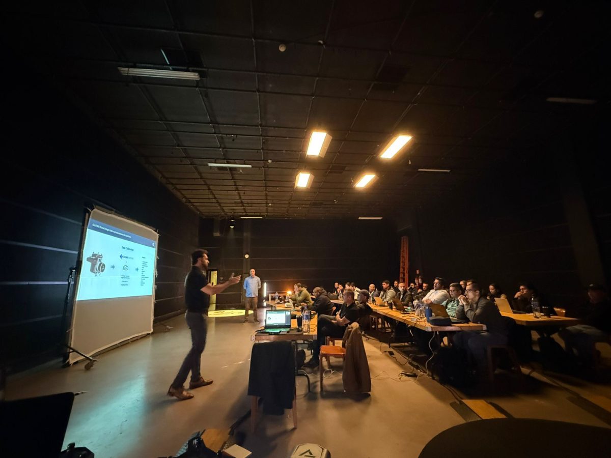
GeoCue is excited to announce its very first LP360 User Conference in Brazil, taking place in São Paulo on November 26-27, 2025. This event marks a new chapter for our community as we extend our reach of LP360 to Latin America. For years, the LP360 User Conference in Huntsville, Alabama, has been a highlight for surveyors, engineers, LiDAR technicians, and geospatial professionals who want to sharpen their skills, learn from experts, and connect with peers. Now, our friends and colleagues across Brazil and Latin America will have the opportunity to experience that same level of training, knowledge, and community.

A New Gathering Place for the LP360 Community

The LP360 User Conference Brazil 2025 will take place at Studio Quanta, an inspiring venue located in the heart of São Paulo. For two full days, participants will immerse themselves in informative presentations, discovery sessions, and real-world case studies designed to unlock the full potential of LP360. Attendees can expect the same high-caliber programming that has made our annual Huntsville conference so valuable. From exploring the latest software updates to diving into specialized workflows for LiDAR and photogrammetry, this event will offer an unmatched opportunity to grow your expertise in geospatial technology.

What You Can Expect

Over the course of the two days, attendees will gain access to a wide variety of sessions designed to both inspire and educate. Presentations from LP360 experts will provide a comprehensive look at the most recent advancements in LiDAR and photogrammetry processing. These sessions will highlight tools and techniques that can dramatically improve project outcomes, efficiency, and accuracy.

Discovery sessions will give participants the chance to go deeper. Guided by our specialized support team, these sessions are structured to help users understand new tools in detail and apply them effectively to their own workflows. Try your hand at scanning, with the TrueView GO. Learn about our TrueView Aerial LiDAR sensors. By combining live demonstrations with interactive discussions, discovery sessions are an ideal environment to ask questions, experiment with features, and leave with practical knowledge ready to be put to work.

Why Attend in São Paulo

For many geospatial professionals across Latin America, attending the Huntsville conference can be a challenge due to distance, time, and cost. By hosting the first annual LP360 User Conference in Brazil, we are removing those barriers and bringing the same level of expertise and learning directly to the region.

This event is ideal for LiDAR technicians, surveyors, engineers, construction data specialists, and anyone looking to expand their geospatial toolkit. Whether you are new to LP360 or have years of experience, the sessions are designed to deliver valuable insights and actionable knowledge. You will not only gain a deeper understanding of the software but also build connections with a community of peers who share your challenges and ambitions.

Networking will be a key part of the experience. In between sessions, you will have the opportunity to meet with other attendees, exchange ideas, and discuss projects. These conversations often lead to lasting professional relationships and open the door to collaborations that extend far beyond the conference itself.

Shaping the Future of LP360

The LP360 User Conference is not just about learning; it is also about contributing. Your feedback, questions, and ideas play an important role in helping us shape the future of the platform. By participating in the Brazil conference, you will have the opportunity to engage directly with our team, share your perspectives, and influence how LP360 evolves to meet the needs of the geospatial community.

Join Us

The LP360 User Conference Brazil 2025 is more than an event. We are proud to be expanding our annual conference to Latin America and cannot wait to welcome participants to São Paulo this November.

Mark your calendars for November 26 and 27 and join us at Studio Quanta for two days of inspiration, learning, and connection. Space is limited, so we encourage you to register soon to secure your spot. Whether you are attending to master new workflows, hear from fellow professionals, or simply connect with others who share your passion for LiDAR and photogrammetry, this event is for you.

We look forward to seeing you in São Paulo for the very first LP360 User Conference in Brazil. Together, let us build on the success of Huntsville and continue shaping the future of geospatial innovation.

Categories
LiDAR Events LiDAR For Construction LiDAR For Education LiDAR For Engineering LiDAR For Utilities & Energy LiDAR News LiDAR Surveying & Mapping LiDAR Training Software News

GeoCue and JM Equipos Bring LiDAR Demo Days to Medellín and Bogotá

Hands-on LiDAR Training in Colombia. Explore Drone Mapping, Handheld Scanning, and Point Cloud Processing with GeoCue and JM Equipos

GeoCue is excited to announce a special opportunity for the Latin American geospatial community, our Demo Days are coming to Medellín and Bogotá this fall! Together with our partner JM Equipos, we’re opening the doors to a hands-on workshop experience where you can try the latest in LiDAR hardware, handheld scanning, and LP360 software for point cloud processing.

Whether you’re an experienced surveyor, an engineer exploring new workflows, or simply curious about how LiDAR can transform your projects, these one-day events are designed to provide practical insights, live demonstrations, and direct access to the experts.

Two Cities, One Big Opportunity

  • Medellín Workshop – September 30, 2025
  • Bogotá Workshop – October 2, 2025

Each Demo Day will feature the same agenda, providing participants in both regions with the opportunity to explore our full range of solutions. Attendance also includes a GeoCue certificate of participation, a great addition to your professional development portfolio.

What You’ll Experience

At the Demo Days, you’ll have the chance to step beyond presentations and truly interact with the technology that’s reshaping the world of surveying, mapping, and reality capture.

1. Drone LiDAR in Action

Our team will showcase GeoCue’s industry-leading TrueView aerial LiDAR sensors, designed to deliver survey-grade accuracy for a wide variety of applications. From infrastructure inspection to forestry and construction, see how drones equipped with LiDAR are revolutionizing the way professionals capture large-scale geospatial data quickly and safely.

2. TrueView GO Handheld Scanner

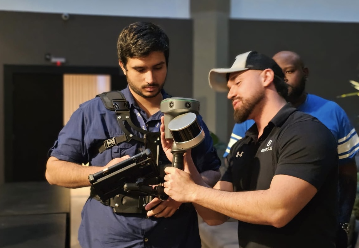
For projects where drones aren’t the right fit—indoor environments, underground spaces, dense vegetation, or areas with GNSS limitations—you’ll get hands-on with the TrueView GO handheld LiDAR scanner. Built with powerful SLAM technology and enhanced by integrated cameras, the TrueView GO makes it easy to scan everything from buildings and tunnels to heritage sites and forensic scenes. It’s lightweight, cable-free, and designed for versatility, making it an essential tool for modern surveyors and engineers.

3. LP360 Software for Point Cloud Processing

Collecting LiDAR is only the first step—the real value comes in processing and analysis. That’s where LP360 comes in. Our comprehensive point cloud software allows you to visualize, QA/QC, classify, and extract deliverables with efficiency and precision. At the Demo Days, you’ll see how LP360 handles both drone LiDAR and handheld SLAM data in a single streamlined workflow. Even better—you’ll learn how to create professional-grade deliverables such as DEMs, DSMs, and 3D models.

Why We’re Partnering with JM Equipos

We’re proud to be working alongside JM Equipos, a trusted leader in the Colombian market. Their deep knowledge of topographic and environmental equipment, paired with a strong focus on customer service, makes them the perfect partner to bring GeoCue technology to a wider audience in Latin America.

About JM Equipos

Mission: JM Equipos is committed to marketing top-quality technology that satisfies not only specialized professionals but also a broad segment of Colombia’s population. Their promise is to deliver the best product alternatives with exceptional after-sales service, ensuring security and confidence for every customer.

Vision: To be recognized as Colombia’s leading technology distributor, offering unmatched after-sales service and setting the standard for trust and innovation in the industry.

Who They Are: JM Equipos has quickly established itself as a premier provider of survey and geospatial equipment across Colombia, especially in the Antioquia region. With more than seven years of experience in the market, Romero has built a reputation for reliability, responsibility, and customer-focused service. Today, JM Equipos continues to build on that legacy, offering engineers, surveyors, construction companies, and beyond the tools and confidence they need to succeed.

With JM Equipos at our side, GeoCue is confident that attendees in Medellín and Bogotá will not only see the technology in action but also discover the support and expertise available locally to help integrate LiDAR into their workflows.

Who Should Attend

These Demo Days are designed for a wide variety of professionals:

Surveyors and Engineers looking to expand their toolkit with drone or handheld LiDAR.

Construction Companies exploring faster, more accurate site documentation.

Environmental and Forestry Specialists interested in new ways to monitor and measure natural resources.

Academics and Students eager to explore the latest in geospatial innovation.

Government and Infrastructure Professionals tasked with managing large-scale projects and assets.

If LiDAR has ever been on your radar, or if you want to explore how to process and maximize the data you already have, this event is for you.

Register Today

Seats for both Demo Days are limited, so don’t wait to secure your spot:

WhatsApp: +57 310 7983526

Email: d.herrera@jmequipos.com | marketing@jmequipos.com

Choose the date and city that works best for you: September 30 in Medellín or October 2 in Bogotá, and get ready for a day of discovery, learning, and hands-on geospatial innovation. See you in Colombia!

Categories
LiDAR Articles LiDAR Events LiDAR News LiDAR Training

Exclusive LP360 Support Sessions at Geo Week 2025

Register Now to Maximize Your LP360 Expertise with Personalized Support Sessions in Denver

Did you miss out on the 2024 LP360 User Conference? Are you looking for personalized support to unlock the full potential of LP360? If you’re on the West Coast or planning to attend Geo Week 2025, we’ve got great news! GeoCue is bringing one-on-one LP360 Support Sessions to Denver, Colorado, making it easier than ever to get the help you need.

Join us during Geo Week 2025, February 12–14, at the Hyatt Regency Denver, conveniently located near the Geo Week venue, for hands-on support and exclusive insights into LP360. Whether you’re tackling specific project challenges, optimizing your data processing workflow, or learning about new features, these sessions are designed to help you succeed.

We also have you covered for Geo Week! To receive a FREE expo hall pass OR $100 off a Geo Week conference pass, register at geo-week.com and enter GEO2530132 when prompted to enter a promo code.

Click the image to register for an LP360 Support Session

On-Site Expertise and Guidance
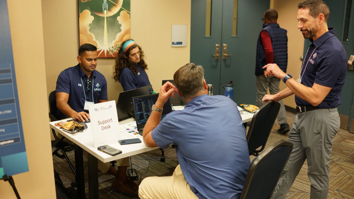
For the duration of Geo Week 2025, LP360 experts will be hosting dedicated support sessions just steps away from the main event floor. Set in the Limestone Room at the Hyatt Regency Denver, this convenient location lets attendees drop in for one-on-one guidance without straying far from conference activities. By reserving your spot in advance, you can secure a 45-minute appointment focused squarely on your unique needs—an incredible $250 value provided at no additional cost.

Take advantage of a 45-minute private session with one of our LP360 experts. Whether you need help troubleshooting, enhancing your workflow, or applying advanced tools like planar filters, point cloud extraction, or volumetric analysis, our experts are here to help. Instead of general advice that may or may not apply to your situation, the LP360 support team will tailor the discussion to your specific project, dataset, and objectives. This hands-on approach ensures you leave with actionable insights that translate directly into more efficient, accurate, and productive data processing back at your office.

Learn at Your Own Pace, at Any Level
The LP360 support sessions are ideal for both newcomers and seasoned users. If you’re just getting started, the team can walk you through the basics, such as understanding LIDAR fundamentals and navigating the LP360 interface. Need to master advanced filters? Ready to improve data extraction methods or streamline your volumetric computations? These sessions let you work with industry experts who have the LP360 knowledge and support you need.

Daily Discovery Sessions to Expand Your Horizons
In addition to one-on-one appointments, LP360 will host daily discovery sessions. 

Monday, February 10: TrueView GO: Learn how the TrueView GO, handheld LiDAR sensor is ideal for a wide range of applications, allowing you to easily capture reality while you walk.AI Classification

Tuesday, February 11: AI Classification–  AI Classification is an exciting new feature available in LP360 Cloud. This session will demonstrate how to use the power of the cloud to generate classifications.

Wednesday, February 12: Breaklines: This session will guide you through using LP360’s extensive tools for adding and enforcing breaklines in topographical modeling. Discover how to create accurate models, especially for features like still water bodies, using polygonal boundaries and breakline enforcement.

Seats for both the support appointments and discovery sessions are limited, ensuring you get high-quality, hands-on attention. With demand likely to be high—especially given the event’s proximity to Geo Week — reserving your spot early is highly recommended.

Why Attend?

  • Personalized Support: Work through your organization’s specific questions and challenges in a private, 45-minute one-on-one session with an LP360 expert.
  • Discovery Sessions: Explore powerful LP360 tools and techniques during daily group sessions designed to inspire and inform.
  • Convenient Location: The Hyatt Regency Denver, hosting these sessions, is right next door to Geo Week, making it easy to incorporate training into your event schedule.

If you’re planning to be on the West Coast or attending Geo Week 2025, don’t miss this opportunity. This is your chance to get expert insights, refine your workflows, and harness the full power of LP360, all in one comfortable, convenient setting. Book your session today and step into Geo Week 2025 ready to make the most of your data.