Categories
LiDAR For Construction LiDAR For Education LiDAR For Engineering LiDAR News LiDAR Surveying & Mapping LiDAR Webinars Software News

What’s New in LP360 v2026.2 Webinar

Join Our November 18 Webinar to Explore the New Immersive Profile, 3D Photo Engine Improvements, E57 Support, and other new updates to LP360

LP360, the professional choice in LiDAR and photogrammetry 3D point cloud software, has released its final feature update of 2026. LP360 v2026.2 is now available, bringing new visualization tools, improved imagery workflows, expanded sensor support, and more ways to inspect, share, and document your projects.

Join us on Wednesday, November 18, 2026, at 10:00 am CT, for our What’s New in LP360 v2026.2 webinar to see the latest features in action and learn how to put them to work in your next project.

When: Wednesday, November 18, 2026

Time: 10:00 am CT
Registration: Register for What’s New in LP360 v2026.2

This informative session will highlight practical improvements across point cloud review, photo processing, sensor workflows, quality reporting, and project management. Whether you work with aerial LiDAR, handheld scans, or imagery, the webinar will help you get more from the latest version of LP360.

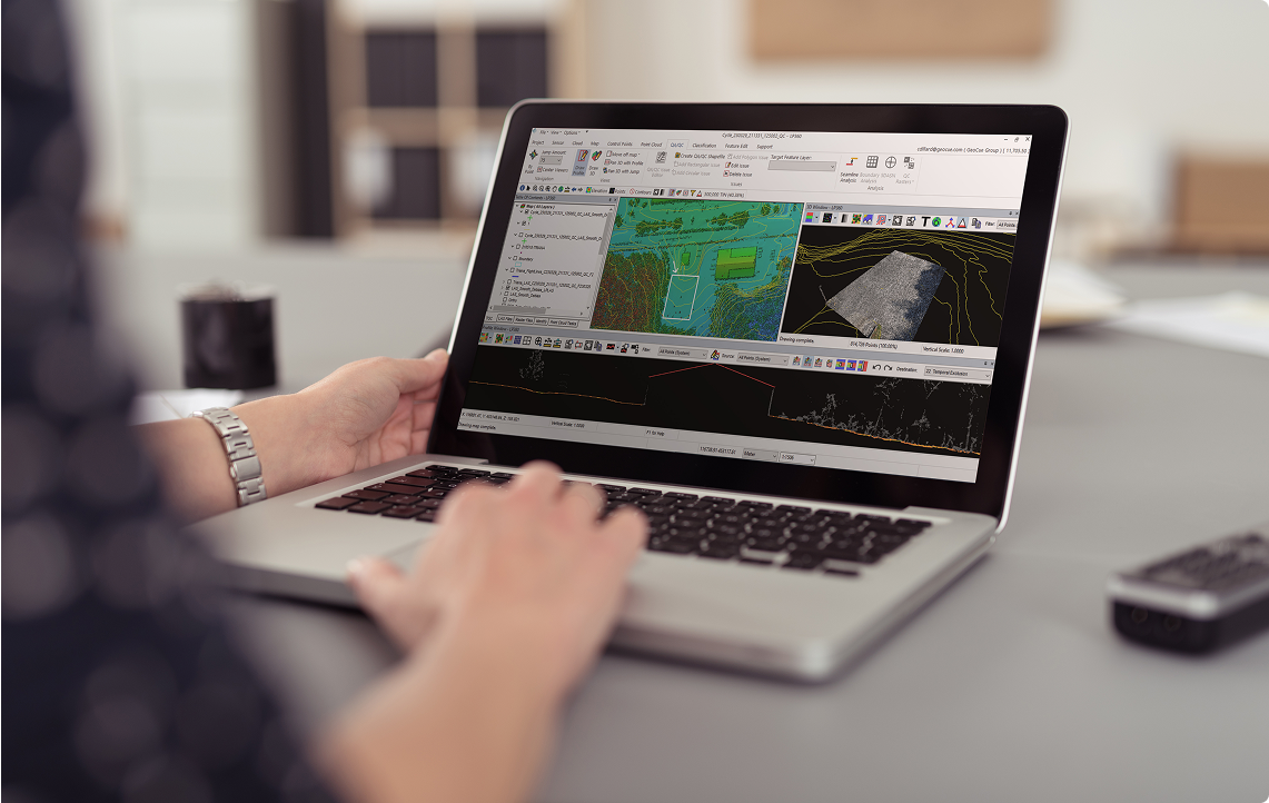
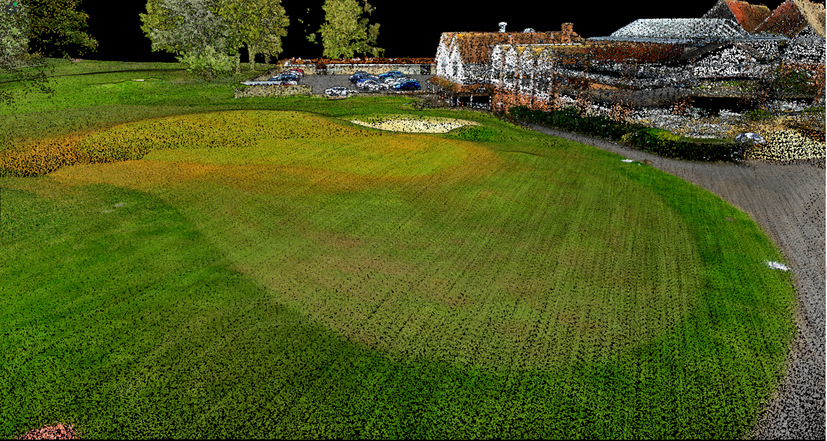
One of the key highlights is the new Immersive Profile, which combines focused cross-section analysis with an interactive 3D view. Rotate, pan, and zoom through your data to better understand how points relate to surrounding terrain, buildings, vegetation, and utilities. Active Filter controls and improved point-density settings help you focus on the details that matter during editing and quality checks. Users can choose the new Immersive Profile or continue working with the Legacy Profile View.

The 3D Photo Engine also receives several improvements designed to produce cleaner imagery products and more consistent results. Expanded AI photo masking adds Operator and Sky options, while improved multi-camera handling keeps calibration and photo information better coordinated after processing. Enhanced colorization for multi-beam sensors, improved DEM input checks, and additional Cloud processing options further streamline imagery workflows. The 3D Photo Engine requires a separately purchased add-on.

For teams working across different software platforms, new E57 import and export capabilities make exchanging point clouds easier. Bring E57 data into LP360 for processing and analysis, or export project data for downstream reality capture, CAD, BIM, and visualization applications. This added flexibility helps simplify collaboration and reduce separate file conversion steps.

LP360 v2026.2 also expands sensor and platform workflows. RESEPI payload support, available as a beta release, allows users to begin with raw payload data in Import Cycle and continue through a guided Sensor processing workflow. Additional updates include Anzu Raptor platform support, RXP Cutter support in applicable RIEGL workflows, improved handling of DJI Terra folders, and refinements for TrueView processing.

New PDF reports for Strip Alignment and Point Cloud Statistics make it easier to review results and document the work behind your deliverables. Geocoding reports for applicable workflows and TrueNav processing reports for TV1 and TV1 Lite provide additional information for project review and quality control.

The release also includes tools to help keep data cleaner and processing more organized. Optional Flyer and Sinker outlier removal helps eliminate stray points during Geocoding, while the new Delete Points by Class tool provides a direct way to remove unwanted classifications before delivery. Job Manager improvements add Project Filter and Sort By controls, helping users find and manage work across multiple projects.

Together with improved coordinate system selection, licensing, diagnostics, and Help Center guidance, LP360 v2026.2 focuses on helping users spend less time managing processing and more time putting their data to work.

Download the latest version, then join us on November 18 to explore what’s new and learn how these updates can improve your LiDAR and photogrammetry workflows.

Register for the webinar or view the full release notes for more details.
Categories
LiDAR For Construction LiDAR For Engineering LiDAR For Utilities & Energy LiDAR News LiDAR Surveying & Mapping LiDAR Webinars

Webinar Re-Play: Watch the Drone Mapping Summit featuring Ouster and GeoCue

Explore Ouster Rev8 technology, practical mapping workflows, and the future of drone LiDAR

Looking to get more from your drone LiDAR workflow? watch the replay of Ouster’s Drone Mapping Summit, a free, 90-minute live webinar in the player below. The event brings together Ouster specialists and industry leaders from GeoCue, Seneca, and Flyability, including our very own COO, Frank Darmayan.

Why is this important for GeoCue customers? The TV1 NDAA UL and TV1 NDAA are the first aerial mapping systems to integrate the Ouster OS1 Max Rev8, expanding the TrueView portfolio with compact options for high-density aerial mapping. The TV1 NDAA UL uses native direct colorization, while the TV1 NDAA adds a 26 MP global shutter mapping camera for projects requiring high-resolution imagery.

Paired with GeoCue’s navigation technology and LP360 processing workflow, these systems help users move from field collection to final deliverables. Understanding the technology behind the sensor is another step toward choosing the right tools for your aircraft, applications, and budget.

What the summit will cover:

Rev8 technology overview — 20 minutes: Explore native color, precision, range, and the compact OS1 Max design.

OS1 Max masterclass — 20 minutes: Review firmware configuration, test datasets in Ouster Studio, and Ouster SDK commands for creating colorized maps.

Industry panel — 50 minutes: Hear GeoCue, Seneca, and Flyability discuss mapping challenges, emerging technology, policy, and career opportunities, followed by live audience Q&A.

The summit is designed for surveyors, mapping providers, drone and payload developers, and teams working with geospatial data. Attendees can also explore sample drone datasets covering utility corridors, forest canopy, and urban environments.

Whether you are evaluating a new LiDAR system or looking for ways to strengthen an existing workflow, join the conversation and bring your questions.

Categories
LiDAR For Construction LiDAR For Education LiDAR For Engineering LiDAR For Utilities & Energy LiDAR News LiDAR Surveying & Mapping LiDAR Webinars

Webinar: How to Make the Switch to NDAA-Compliant Drone Mapping with Inspired Flight and GeoCue

Make the switch to NDAA-compliant drone mapping with Inspired Flight platforms, GeoCue TrueView LiDAR payloads, and LP360 Drone software.

There’s a lot of conversation right now around NDAA-compliant drone mapping, and for good reason. As requirements continue to change and more organizations take a closer look at the drone platforms and LiDAR payloads they use, many teams are starting to plan their move away from Chinese-made drone systems.

The good news is, making the switch doesn’t have to be complicated. With the right drone platform, the right LiDAR payload, and the right processing software, you can build a complete NDAA-compliant aerial mapping workflow with confidence.

To help make that transition easier to understand, GeoCue is excited to partner with Inspired Flight for a special upcoming webinar, How to Make the Switch to NDAA-Compliant Drone Mapping with Inspired Flight and GeoCue, taking place on Wednesday, June 17, 2026, at 1 PM CT.

This informative session is designed for drone mapping professionals, surveyors, public safety teams, engineering firms, government agencies, and anyone evaluating their next aerial LiDAR investment. If you’re currently using a non-NDAA drone platform, preparing for new requirements, or simply looking for a more reliable and professional drone LiDAR solution, this webinar will help you understand your options and make the switch with confidence.

Why NDAA Compliance Matters for Drone Mapping

For many organizations, drone mapping is no longer just about collecting accurate data. It’s also about meeting procurement requirements, protecting sensitive project information, and ensuring that the technology used in the field aligns with internal, state, federal, or customer-specific security expectations.

As NDAA compliance becomes a more important consideration across public-sector and enterprise drone programs, mapping professionals need to understand how these requirements may impact their equipment decisions. During the webinar, Inspired Flight and GeoCue will review key FAA rules and requirements, discuss what drone mapping teams should be thinking about, and explain how to build a complete workflow around NDAA-compliant hardware and software.

Meet Inspired Flight’s NDAA-Compliant Drone Platforms

Inspired Flight has become a trusted U.S. drone manufacturer, offering professional platforms designed for demanding commercial, industrial, and government applications. In this webinar, attendees will get a closer look at two of Inspired Flight’s NDAA-compliant drone platforms: the IF800 Tomcat and the IF1200.

The IF800 Tomcat is a powerful and portable platform built for professional drone operations. It offers strong payload flexibility, reliable performance, and an efficient design for teams that need a capable aircraft for mapping and inspection workflows.

The IF1200 is designed for heavier payloads and more demanding missions, making it a strong option for organizations that require increased lift capacity, rugged performance, and mission flexibility.

Inspired Flight will provide a company overview and walk through the features and benefits of each platform, helping attendees understand which aircraft may be the right fit for their mapping needs.

Explore GeoCue’s NDAA-Compliant TrueView LiDAR Payloads

A drone platform is only one part of the equation. To build a complete NDAA-compliant aerial mapping workflow, you also need a professional LiDAR payload that can deliver the accuracy, reliability, and efficiency your projects require.

GeoCue will provide an overview of its NDAA-compliant TrueView LiDAR payload lineup, including the TrueView 641, 651, 655/660, 680/680LR, and 720. These systems are designed to support a wide range of aerial mapping applications, from surveying and engineering to infrastructure, utilities, construction, public safety, and advanced geospatial projects. The TrueView lineup gives organizations a clear path to build the right NDAA-compliant LiDAR solution for their workflow, from everyday mapping projects to more demanding applications.

A Complete Workflow with LP360 Drone

In addition to hardware, this webinar will also highlight the importance of processing software in the drone LiDAR workflow. GeoCue will review the LP360 Drone processing workflow and show how LP360 helps users move from data collection to finished deliverables.

By combining Inspired Flight’s NDAA-compliant drone platforms, GeoCue’s TrueView LiDAR payloads, and LP360 Drone software, organizations can transition to a complete professional mapping workflow with confidence.

Join Us on June 17

If you’re looking to replace Chinese-made drone platforms, prepare for changing requirements, or evaluate your next drone LiDAR investment, this webinar is a great opportunity to learn directly from the teams at Inspired Flight and GeoCue.

Together, Inspired Flight and GeoCue offer a reliable, professional solution for organizations ready to make the move to NDAA-compliant drone mapping.

Join us on Wednesday, June 17, 2026, at 1 PM CT for How to Make the Switch to NDAA-Compliant Drone Mapping with Inspired Flight and GeoCue.

Register today to learn how you can confidently transition to a complete NDAA-compliant aerial mapping workflow.

Categories
LiDAR For Utilities & Energy LiDAR News LiDAR Webinars

LP360 AI Classification Add-Ons Webinar:  Meet the New LP360 AI Classification Add-Ons

Explore how LP360 AI Classification Add-Ons streamline LiDAR point cloud processing, reduce manual classification, and improve geospatial workflow productivity.

GeoCue is excited to invite you to our next LP360 webinar, Meet the New LP360 AI Classification Add-Ons, taking place on Wednesday, May 27, 2026, at 10:00 AM CST.

As LiDAR projects continue to grow in size and complexity, users are always looking for ways to reduce manual processing time, simplify classification workflows, and move from raw data to finished deliverables more efficiently. The latest AI Classification Add-Ons in LP360 are designed to do exactly that.

In this informative webinar, we’ll take a closer look at the new cloud-powered AI classification tools now available in LP360 and show how they can help streamline point cloud classification across a wide range of applications, including surveying, forestry, utilities, infrastructure, mapping, and geospatial production workflows.

Attendees will get a guided overview of the new AI Classification tab inside LP360 and see how these tools fit into the existing LP360 processing workflow. Whether you’re looking to improve ground classification, extract advanced features, analyze forestry data, or support utility corridor mapping, these new AI-powered tools can help reduce manual cleanup and give you a faster path to reliable deliverables.

The webinar will highlight the available AI Classification bundles, including AI Ground Only, AI Ground+ Classification, AI Forestry, and AI Utilities.

AI Ground Only is designed to help automate ground and non-ground segmentation, giving users a faster way to begin the classification process and reduce the amount of manual editing typically required.

AI Ground+ Classification expands on that capability by identifying additional above-ground features such as vegetation, buildings, roofs, walls, vehicles, bridge decks, water surfaces, and more. This gives users a more complete classification starting point for complex projects and helps improve overall workflow efficiency.

For forestry applications, AI Forestry provides powerful tools for tree segmentation and vegetation analysis. We’ll review outputs such as individual tree locations, DBH points, crown polygons, canopy height model raster outputs, and other forestry-focused deliverables that can help users better understand and analyze LiDAR data in forested environments.

We’ll also explore AI Utilities, which is designed to support transmission line and utility corridor workflows. This tool can help identify and classify key utility features, including vegetation, wires, towers or poles, insulators, cables, guard wires, jumper wires, and attachment points. For users working in utilities, vegetation management, or corridor mapping, this can provide a more efficient way to extract meaningful information from complex datasets.

Throughout the webinar, we’ll discuss how these AI tools can help reduce manual classification and cleanup time while still keeping users in control of their final deliverables. AI classification is not intended to replace professional review and QA/QC, but it can serve as a powerful accelerator inside the LP360 workflow.

Join us on Wednesday, May 27, 2026, at 10:00 AM CST to see how LP360’s new AI Classification Add-Ons can help you work faster, simplify your processing workflow, and get more value from your LiDAR data.

Register now:

https://lp.lp360.com/webinar-meet-the-new-lp360-ai-classification-add-ons
Categories
LiDAR Webinars Software News

What’s New in LP360 v2026.1 Webinar

Join Our April 22 Webinar to Explore New AI Classification Tools, the 3D Photo Engine, and More in LP360 v2026.1

LP360, the professional choice in LiDAR and photogrammetry 3D point cloud software, continues to evolve with new tools and workflow enhancements designed to help users process data faster, visualize projects more clearly, and produce better deliverables. The upcoming What’s New in LP360 v2026.1 webinar will highlight the latest additions to the platform, including new AI classification tools, expanded photogrammetry capabilities, enhanced visualization, and support for new sensor workflows. The live webinar is scheduled for Wednesday, April 22, 2026 at 10:00 AM CT.

You can register now using the link below:

Registration: https://lp.lp360.com/webinar-what-s-new-in-lp360-2026-1/

When: April 22, 2026

Time: 10:00am CT

In this informative session, attendees will get an inside look at the newest features in LP360 v2026.1 and learn how these updates can improve efficiency across LiDAR and imagery workflows. The webinar will cover major additions across sensor support, photogrammetry, visualization, AI-driven classification, and overall workflow improvements, helping users work smarter from data import to final deliverables.

One of the key highlights in LP360 v2026.1 is support for the new TrueView 651 NDAA-compliant payload in the Import Wizard and Sensor Processing workflow, along with support for the DJI Zenmuse L3 processed workflow in Import Cycle and Post Processing. The release also introduces the new 3D Photo Engine and Photo tab, giving users a more powerful way to create orthophotos, colorized point clouds, and photogrammetry outputs from a single interface.

Additional improvements include enhanced orthomosaic generation using both point cloud and orthophoto data improved by ground LiDAR, higher-quality LAS colorization, and Photogrammetry Quality Reports for better QA and project review. LP360 v2026.1 also adds support for 3D Gaussian Splat visualization, offering a more immersive way to inspect data and improve spatial understanding during review workflows.

The update also introduces a major expansion of AI Classification tools, including AI Ground, AI Ground+, AI Forestry, and AI Utilities. These tools are designed to support a broad range of geospatial applications. AI Ground+ enables automatic segmentation of features such as ground, vegetation, roofs, roof objects, walls, vehicles, bridge decks, and water surfaces. AI Forestry supports tree segmentation and forestry-ready outputs such as individual tree locations, DBH points, crown polygons, and CHM rasters. AI Utilities is built for transmission line workflows, supporting the classification and extraction of vegetation, wires, towers or poles, insulators, cables, guard wires, and attachment points.

LP360 v2026.1 also includes support for the ASPRS LAS v1.5 specification, along with updated translations, classification tab enhancements, help updates, bug fixes, and general stability improvements. Altogether, this release brings meaningful upgrades for professionals working in surveying, engineering, construction, utilities, forestry, public safety, and geospatial mapping.

Join us on April 22 to see these new features in action and discover how LP360 v2026.1 can help streamline your LiDAR and photogrammetry workflows from start to finish.

Categories
LiDAR Webinars

Webinar Replay: Meet the TrueView GO Product Portfolio

Handheld LiDAR Mapping for Any Environment

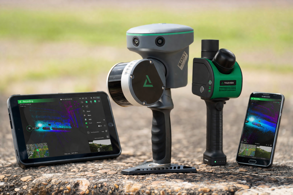
If you’re thinking about handheld LiDAR for indoor mapping, outdoor survey work, infrastructure documentation, or digital twin creation, our upcoming webinar is designed to help you understand which system is the right fit for your needs. Watch the replay of Meet the TrueView GO Product Portfolio, an informative session covering the full TrueView GO handheld SLAM LiDAR lineup, including the TrueView GO NEO, TrueView GO 116S, and TrueView GO 132S.

The TrueView GO portfolio delivers a complete range of handheld SLAM LiDAR mapping solutions built to capture reality quickly and efficiently in any environment. With the TrueView GO NEO optimized for indoor mapping and the TrueView GO 116S and 132S designed for outdoor and infrastructure applications, the portfolio gives users a path to handheld mapping based on environment, project demands, and budget.

In this webinar, attendees will get a closer look at how the TrueView GO portfolio is structured to support both indoor and outdoor mapping applications. The session will review the core differences between the NEO, 116S, and 132S, while also helping viewers understand which scanner is best suited for their environment, accuracy requirements, project scale, and performance expectations.

One of the key strengths of the TrueView GO family is that it offers a scanner for every mapping scenario. For teams working primarily indoors where GNSS is unavailable and SLAM performance is critical, the TrueView GO NEO provides a compact, efficient solution for applications such as building documentation, facility management, construction monitoring, industrial sites, and digital twin creation.

For users working outdoors, the TrueView GO 116S is designed for professional handheld mapping with integrated GNSS to improve efficiency and trajectory accuracy, making it a strong fit for roads, utilities, infrastructure, urban asset inventory, construction sites, and environmental surveys.

For more demanding projects that require higher point density, more range, and more detailed point cloud data, the TrueView GO 132S is built to handle complex outdoor environments with added performance.

Another major advantage is the processing software behind the portfolio. Every TrueView GO system includes LP360 Land software, allowing users to move from acquisition to deliverables in one complete workflow. LP360 supports processing, QA/QC, colorization, editing, and deliverable generation, including colorized point clouds, 3D mesh models, Gaussian splatting visualizations, immersive 360 navigation environments, contour products, surface and volume outputs, and control point accuracy reports. Together, the hardware and software combination make it easier for organizations to adopt handheld LiDAR without piecing together multiple tools.

This session will be especially valuable for professionals and organizations evaluating handheld LiDAR for building documentation, digital twins, utilities, infrastructure, construction, and outdoor survey projects. Whether you are looking for an affordable indoor mapping solution, a professional outdoor handheld unit, or a higher-density system for more demanding field conditions, this webinar will help clarify where each TrueView GO model fits and how to choose the right one with confidence.

What we’ll cover:

  • The structure of the TrueView GO portfolio for indoor and outdoor mapping
  • The differences between the TrueView GO NEO, 116S, and 132S
  • Which scanner is best suited for your environment, accuracy needs, project scale, and budget
  • How integrated LiDAR, imaging, GNSS, and SLAM technologies improve field productivity
  • How LP360 supports processing, QA/QC, colorization, editing, and deliverable generation
  • What makes the TrueView GO portfolio a strong solution for flexible handheld mapping

If you are looking for a handheld LiDAR solution that matches your mapping environment, performance requirements, and budget, this is a webinar you won’t want to miss. Join GeoCue for a practical overview of the full TrueView GO portfolio and come away with a clearer understanding of which system is the right fit for your next project.

Categories
LiDAR News LiDAR Webinars

Webinar: Meet the New Volume Ribbon

How to Easily Compute Volume with LiDAR in LP360

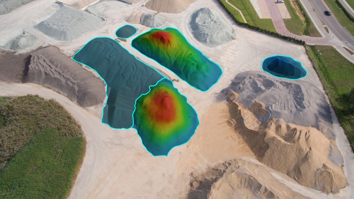
If you work with stockpiles, site grading, earthwork, or terrain change, you know the goal is simple: get a consistent, repeatable volume answer without slowing down your workflow. That is exactly what GeoCue’s upcoming webinar, Meet the New Volume Ribbon, is designed to help you do. Join us on Wednesday, March 25, 2026 at 10:00 a.m. CT to see how the updated Volume Ribbon in LP360 makes volumetrics easier, faster, and more organized. Click the image below, to register.

Date: Wednesday, March 25, 2026

Time: 10:00am CT

Registration: https://lp.lp360.com/webinar-meet-the-new-volumes-ribbon

In this presentation, you’ll learn how the new Volume Ribbon brings the key tools and settings for volumetric workflows into one place. Instead of jumping through extra steps, LP360 users can define an area, apply the right rules, compute volume, and manage outputs more efficiently. The result is a smoother workflow with faster setup, fewer clicks, and more repeatable results for your next project.

Attendees will get a closer look at how to run stockpile and cut/fill volumes faster using the Volume Ribbon, how to use the Compute Volume dialog to tighten workflow and reduce setup time, and how to properly import and manage 3D polygon areas of interest without the usual trial and error. The webinar will also cover how to select the right outputs, including volume attributes, cut/fill images, and optional LAS outputs.

What we’ll cover:

  • The Compute Volumes dialog and how it tightens up the workflow
  • Cleaner setup with improved Import Area Features
  • How to manage outputs using the Volumes Layer dropdown
  • When to use Quick Compute Volume for fast checks and sanity validation
  • Best Practices

If you want to make volumetrics easier than ever in LP360, this is a webinar you will not want to miss. Join us for a practical walkthrough and live demonstration, and come away ready to get more from LP360 on your very next project. Register today through the webinar landing page.

Who should attend:

  • Construction & earthwork teams doing cut/fill, grading checks, progress tracking, and pay quantities
  • Mining, aggregates & quarry operations measuring stockpiles, inventory, and production volumes
  • Surveyors & geomatics pros delivering volume reports for clients, contractors, or internal stakeholders
  • Land development & site prep teams comparing surfaces across phases (pre/post, design vs as-built)
  • Civil engineers & project managers who need defensible numbers and clean outputs for decisions
  • Drone/UAS mapping teams turning point clouds into actionable volumetrics without extra steps

Please note: The Volumetric tools require LP360 Geospatial Standard and above, LP360 Drone, or LP360 Land Standard. We look forward to your participation in this webinar.

Categories
LiDAR Articles LiDAR Case Studies LiDAR For Construction LiDAR For Education LiDAR For Engineering LiDAR News LiDAR Webinars

How to Create 911 Ready Digital School Maps with Handheld LiDAR and LP360

NOW AVAILABLE ON YOUTUBE: DOWN TO EARTH: MAPPED SAFE FOR 911

Down to Earth, a surveying reality series, shows how real professionals capture reality and turn it into real deliverables, even when the mission is urgent and the stakes are high.

Fenstermaker, NEI, and Lafayette Parish 911 Partner to Create Digital School Maps That Give First Responders a Head Start When Seconds Count

When an emergency call comes in, details matter, and so does time. In this three-part Down to Earth edition, follow Fenstermaker, NEI, the Lafayette Parish School System, and Lafayette Parish 911 as they take on a critical mission: mapping every public and private school across the parish, inside and out, to help police, fire, and EMS crews respond faster and smarter.

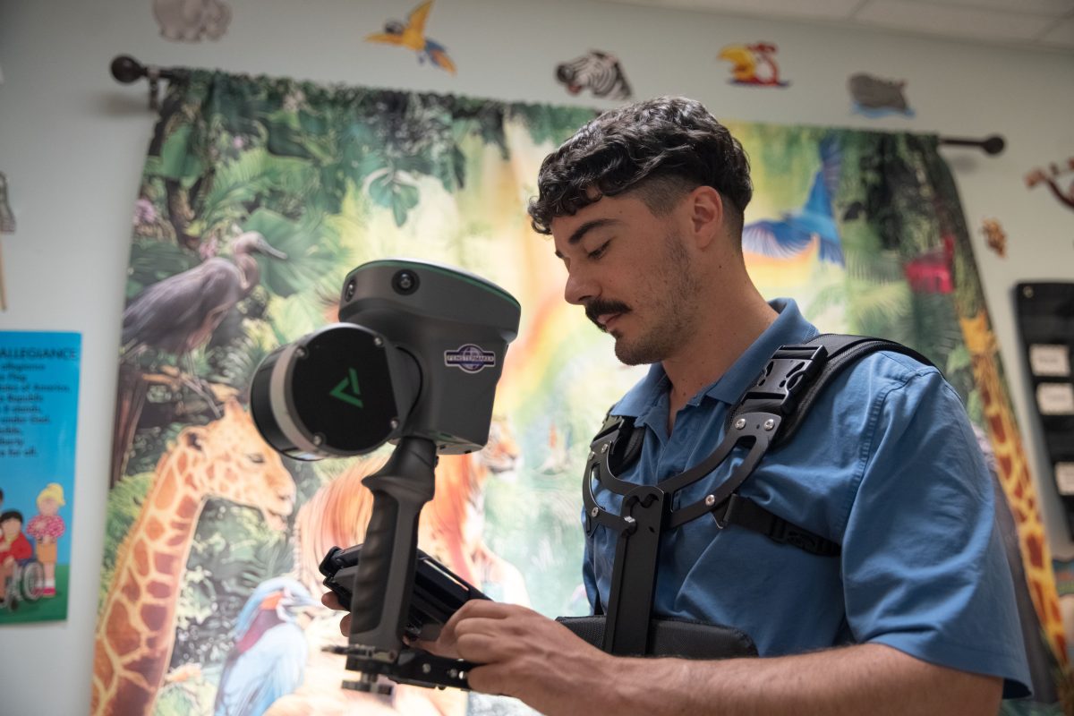
Using the TrueView GO handheld LiDAR scanner and LP360 software, the team captures complete interior and exterior scans, then turns that data into 911-ready deliverables, including detailed point clouds, floor plans, and GIS layers that can be accessed through the 911 Computer Aided Dispatch system.

“Everyone recognized that a mapping system was needed for schools,” said Craig Stansbury, Director at Lafayette Parish 911. “Schools and children are some of our most vulnerable populations. Being able to see accurate digital maps in our units before we arrive means first responders can plan their route, know exactly where to go, and get there as quickly as possible to render aid.”

Watch Episode 1 below:

In Episode 1, you’ll meet Fenstermaker, a third generation, family owned engineering and surveying firm operating in Louisiana, Mississippi, New Mexico, and Texas. What started as an asset management and security initiative quickly evolved into something bigger: a complete digital mapping program designed to get accurate school layouts into the hands of first responders.

“Data is king, but it has to be usable,” said Coy LeBlanc, Remote Sensing Scientist at Fenstermaker. “With the TrueView GO, we can walk a classroom once and know it’s fully captured. We’re scanning schools in record time and turning that data into floor plans that 911 can trust when the call comes in.”

Watch Episode 2 below:

Episode 2 heads into the field at Westminster Christian Academy and other schools throughout Lafayette Parish. See how quickly the team can deploy the TrueView GO, connect to the tablet, and start capturing classrooms, hallways, and building exteriors with a workflow built for speed.

NEI played a key role in getting the program off the ground.

“As soon as we heard what Fenstermaker was doing, our sales team realized the TrueView GO was the perfect match,” said Mark Forsyth, Director of Sales at NEI. “We delivered the system, completed training the same day, and within three days they were in schools capturing data and importing it into their internal systems. The speed and efficiency were exactly what this project demanded.”

Watch Episode 3 below:

In Episode 3, the action moves from the hallways to the office, where raw TrueView GO data becomes 911 ready deliverables. Fenstermaker imports scan cycles into LP360, uses control points to tighten accuracy, and stitches multiple scans into one clean, comprehensive LAS dataset per school.

From there, the data flows into tools like Autodesk Recap, Revit, and ArcGIS Pro to create 2D floor plans and GIS layers that Lafayette Parish 911 can load into an indoor viewer for responders.

“From a 911 perspective, our main goal was to get these school maps into our CAD and onto the computers in our vehicles,” said Stansbury. “Now responders can see the layout on their tablets before they even arrive, plan their route to a problem area, and make better decisions under pressure. Fenstermaker and their technology partners made that possible.”

Down to Earth: Mapped Safe for 911 demonstrates how combining handheld LiDAR, LP360, and GIS can create a scalable blueprint for school safety, one that other parishes, counties, and agencies can follow.

Categories
LiDAR News LiDAR Surveying & Mapping LiDAR Webinars Software News

Webinar Replay: What’s New in LP360 v2025.2

Learn About the Latest Updates, Features, and Enhancements in LP360 v2025.2

LP360, the professional choice in LiDAR and photogrammetry 3D point cloud software since 2006, continues to expand its capabilities with every release. The latest update, v2025.2, introduces new tools, enhanced workflows, and smarter visualization options designed to accelerate your data processing, making it faster, more intuitive, and more efficient within an intuitive GIS environment. Click the image below to watch the webinar replay:

We’re excited to share the newest updates in LP360 v2025.2.

You can register for the replay by clicking the link below:

Registration: https://lp.lp360.com/webinar-what-s-new-in-lp360-2025-2/

In this informative webinar, we’ll walk you through the latest features added to LP360, demonstrate how these updates enhance your workflows, and show you the new capabilities directly inside the software.

The latest version of LP360 v2025.2 is now available for download and includes a powerful list of enhancements. New and updated features include:

• New Volumes Tab

• Breakline Support for Export LandXML TIN

• Immersive Image Explorer

• Full Support for the New TrueView 539

• 3D Mesh Modeling for TrueView GO Cycles

• Streamlined TopoDOT Export Tools

• Improved Statistical Noise Point Filter PCT

• Cloud-Enabled Trajectory Processing for Applanix Systems

• Updated Strip Align Workflow

• Agisoft Ortho Mapping in the Cloud

• GUI Enhancements

• TrueView GO Workflow Improvements

• General Improvements & Bug Fixes

Watch now to get an inside look at these enhancements, see them in action during our demonstration, and learn how LP360 v2025.2 can streamline your next LiDAR or photogrammetry project.

Categories
LiDAR Articles LiDAR News LiDAR Webinars

Webinar: Precision at Altitude: How Trimble and Applanix is Powering the Next Generation of UAV Operations

Featuring GeoCue’s Martin Flood alongside Trimble and Applanix experts, sharing real-world insights into next-generation UAV precision and performance.

Live Webinar | Wednesday, August 27 | 1:00 PM ET / 10:00 AM PT

In today’s UAV landscape, real-time precision is no longer optional—it’s essential. Whether flying at altitude for mineral exploration, navigating complex urban airspace for medical delivery, or streamlining professional-grade surveys, UAV operators are demanding accuracy, reliability, and workflow efficiency on a global scale.

In this exclusive webinar presented by Inside GNSS and Inside Unmanned Systems, Trimble | Applanix and industry partners showcase how CenterPoint RTX and APX RTX solutions are redefining what’s possible in UAV-based mapping, delivery, and inspection. You’ll hear directly from innovators working at the frontlines of UAV deployment in critical industries, and learn how real-time GNSS correction and direct georeferencing are enabling new levels of performance—without the need for local base stations or cumbersome post-processing.

Register here: Precision at Altitude: How Trimble | Applanix is Powering the Next Generation of UAV Operations

The Expert Panel:

  • Joe Hutton, MASc, P.Eng., Director, Inertial Technology and Airborne Business, Trimble Applanix
  • Ivan Monroy Ortiz, P.Eng., Manager, Operations and Engineering, Volatus Aerospace
  • Martin Flood, Vice President, Special Projects, GeoCue Group, Inc.
  • Trond Løke, Chief Executive Officer, Norsk Elektro Optikk AS (NEO)